A goal of mine
KaktusJaque
Posts: 141 Member
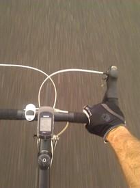
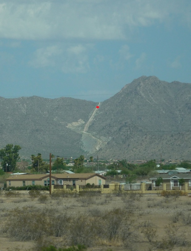
Ok, I made mention about this a while back and wanted to follow up. I have me a goal to work on. Near my house is a place called the White Tank Proving grounds or otherwise known as the Catipillar Proving Grounds. Around the Phoenix area there are many “Proving” grounds for various auto makers. They like the desert to test their cars in the extreme heat, and before the surge in population growth, due to this area being so remote (at the time), Phoenix also offered these manufacturers a bit of privacy to test their secret cars before they released them to the public. Catipillar was one of those companies that had a Proving ground, but in addition to the heat, they wanted a steep grade to run their vehicles up for testing. It is reported that their very famous Cat D9 was tested here. This test road is what you see in the picture below from Interstate 10. Catipillar pulled out long ago before the urban sprawl approached it leaving behind only building pads and this road. Today at the base of the road, housing developments began to put in the water lines, house pads and the streets before the housing market crashed in 2004ish. It's pretty much abandoned right now. I guess when things get better they will pick up again with building, but I digress. It's been one of my goals to ride up this road without stopping. The elevation gain is apx 610 ft in about 1mile with grades from 8% to 16% before reaching the top. I attempted this once before but almost made it all the way up before I had to throw in the towel, I just couldn’t go any further.So not wanting any hill to get the best of me, I vowed to return some day to gain braging rights. Anyway, I will post my progress toward this goal here. Not quite ready....but real soon.

My last attempt, this is where I stopped, looking down
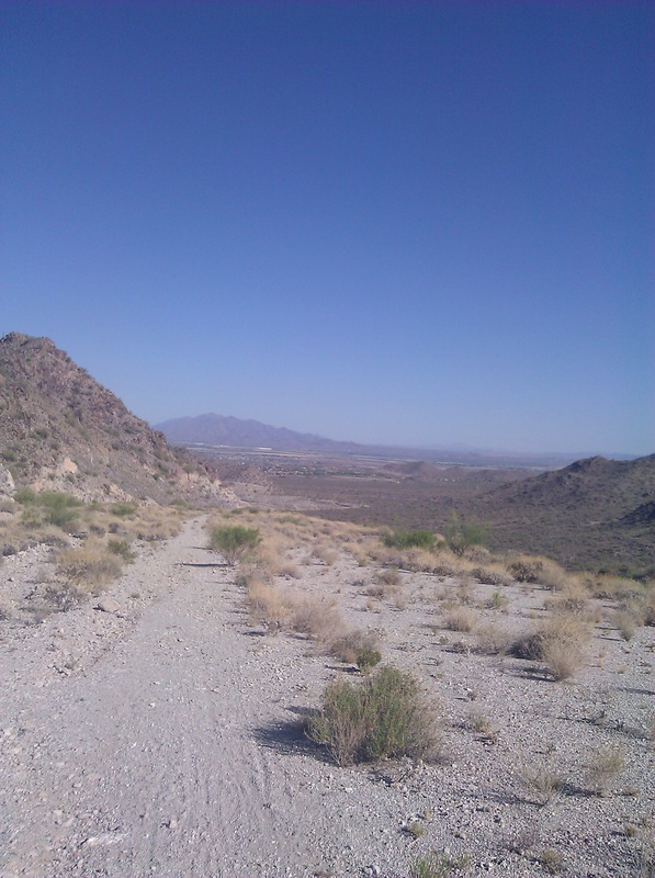
Looking up from the same location, I didnt have all that far to go.
My last attempt, this is where I stopped, looking down
Looking up from the same location, I didnt have all that far to go.
0
Replies
-
Looks like fun! Stay at it and you will make it.0
-
That looks awesome! I miss AZ. I've been collecting bicycling excursions for my Houston to Oregon move this Fall, and this has made the list! Thank you!
 0
0 -
The last bit looks brutal!0
-
That looks awesome! I miss AZ. I've been collecting bicycling excursions for my Houston to Oregon move this Fall, and this has made the list! Thank you!
Real easy to get to the trail head from I-10. Would be good to do in the fall as well.
Here is the mapmyride course
http://www.mapmyride.com/routes/edit/462066314/0 -
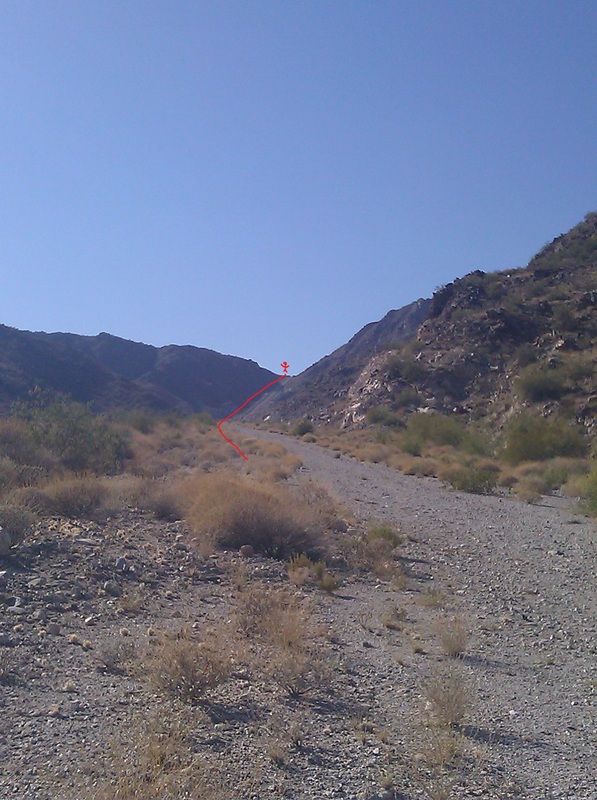
the star marks the spot I had to stop. Soooo close.
 0
0 -
Oh my heavens!!! That is straight up! You can do it!!!0
-
Awesome! You will kick it's *kitten*!!
What gear ratios do you have?0 -
Impressive!0
-
Being from the mid-Atlantic I've got no frame of reference; but that looks absolutely brutal!0
-
Awesome! You will kick it's *kitten*!!
What gear ratios do you have?
rear is 11 - 34
front 22/32/44
So I do have a pretty good granny gear.0 -
Being from the mid-Atlantic I've got no frame of reference; but that looks absolutely brutal!
The picture from the highway makes it look a worse that it actually is, but it does look nasty from the highway for sure.0 -
What exit off 10 do you take ?? Directions after that to get to the trail head ??
One thing, it appears that from the pictures it is more than a mile long....but I'm guessing based on previous comments, the pictures are deceiving ??0 -
Take exit 120 (Verrado Way) and head North for just over 2 miles to W. Lost Creek Dr.What exit off 10 do you take ?? Directions after that to get to the trail head ??
One thing, it appears that from the pictures it is more than a mile long....but I'm guessing based on previous comments, the pictures are deceiving ??
Turn Left (West) and go for about 1 ¼ miles to the trail head.
From the trail head to the top is about 4 miles, actual hill climb starts about 2 miles from the top. The trail is not really a trail, it's a dirt road. However there are a lot of other single track trails in this area. It is one of the local places to go to. On a cool factor scale of 1 to 10, I would give this area a 6ish. However there is a huge boulder that has petroglyphs from the ancient Hohokm Indians that lived in this area which is a nice thing to ride up on. It's protected by a chain link fence with barb wire.
The best rated trail in this area is a trail/s called FINS or Fantasy Island North (the original Fantasy Island trail is in Tucson and is a blast to ride on and I would recommend this ride if you had the time as well) FINS is bit further off of I-10 but if you want some nice fun single track, this would also be a good place to go.0 -
Ok made another attempt to ride up this mountain today. I made it to the really steep part (far left in the picture), but not without having to stop once.
Here is what the approch looks like. I passed this hiker three times lol. He went all the way to the top.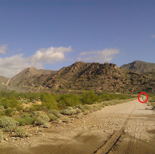
here is where I stopped looking down. Also where the hiker caught up to me.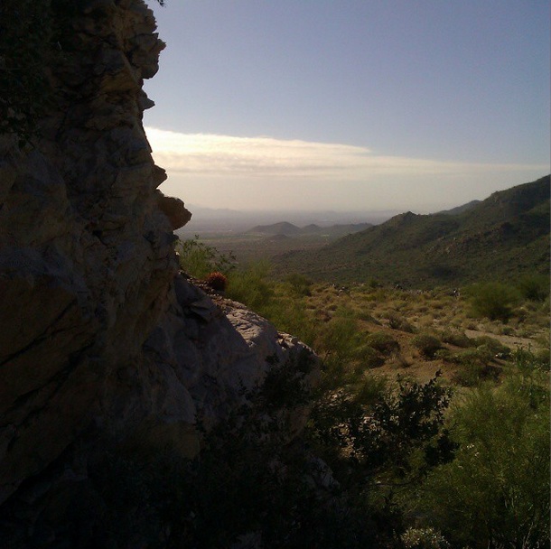
I only made it about 100 yards up the really steep part. Its about a 23% grade. I will need to work on my fitness level to be able to make it up this, especially after riding up the previous hill. I'm also dead last on the local leader board for riding up this hill, lol.
I passed that hiker again on the way down.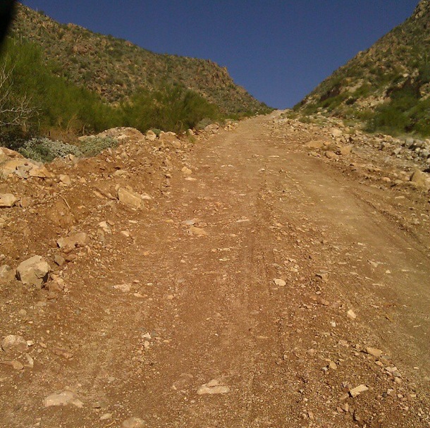 0
0 -
Great pics and I liked reading the report. When the incline gets over 20% I go fully anaerobic, even on a MTB, so I think I'd be stopping there more than once!
Hey, check this out this funny "guide" to climbing grades")
http://www.fatcyclist.com/2012/08/01/a-handy-guide-to-climbing-grades/0 -
Loved the article! Thanks. This last bit of hill will be hard as hell; I’m not going to lie. The 100 yards or so that I was able to do, I did get some back tire spin out because it's loose dirt. The bad thing with this grade is once you stop you’re kinda messed up, because starting out again is difficult in that the back tire spins as you’re trying to get back on the bike, and the bike just does not move forward, the momentum is not there for you to get back on the bike. It took me 3 or 4 tries to get going again.0


This discussion has been closed.