Early impressions of Wahoo Bolt

jjpptt2
Posts: 5,650 Member
I live in the country, and there are a lot of rural roads that offer great riding/exploring opportunities, but navigating them can be tough. So when I was in the market for a new bike computer, navigation was something I researched pretty heavily. After a lot of debate, I went with the Wahoo Elemnt Bolt.
I've got about 100 miles on the computer and here are my early impressions -
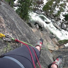
I did my first real exploratory ride over the weekend. 33ish miles wandering around back country roads exploring an area I'd never been in before (not on a bike or in a car). It was great. I planned out the route in RideWithGPS, pushed the route to my Bolt, and hit the road. Navigation worked as well as I ever could have hoped. I sat back and enjoyed the ride while the Bolt navigated me around. I can't wait to do more of this type of riding.
A few pictures, for those who care (assuming I can get them to work/post correctly)...


I've got about 100 miles on the computer and here are my early impressions -
- First and foremost, I really like the way the navigation works. The map offers just enough data/readability to be useful, and the cues work perfectly.
- Customizing the data screens is, um, flexible enough. It's not prefect, but my complaints are really, really nit-picky here.
- I've yet to have any problems seeing/reading the screen, even with 7 data fields being displayed. All that data can be a lot to take in at a glance, but readability is not an issue.
- The companion app is fantastic, and tweaking settings mid-ride is no problem.
- GPS signal reliability doesn't seem to be quite as strong as my old garmin was, but I'm probably much more aware of signal strength now than I ever was with my old 920 (it's a new device, I'm asking more of it, and I'm paying closer attention to the data than with my garmin). So I wouldn't go so far as to say this is a criticism as much as it is something I'll be paying attention to on future rides. So far it hasn't been a problem, just something I've noticed once or twice.
I did my first real exploratory ride over the weekend. 33ish miles wandering around back country roads exploring an area I'd never been in before (not on a bike or in a car). It was great. I planned out the route in RideWithGPS, pushed the route to my Bolt, and hit the road. Navigation worked as well as I ever could have hoped. I sat back and enjoyed the ride while the Bolt navigated me around. I can't wait to do more of this type of riding.
A few pictures, for those who care (assuming I can get them to work/post correctly)...


4
Replies
-
Thanks for posting this. Garmin has owned the market for too long, they're starting to face some good competition, and that's great for all of us cyclists.
If you're starting to explore roads you've never been on because you're comfortable that you can find your way back now, that alone is worth the money.0 -
For yesterday's commute home, I took the scenic route, which became even more scenic when I took a couple of wrong turns. I hadn't been using routing/guidance at that point because I thought I knew my way, but it gave me a good opportunity to test out the on-the-fly routing. I pulled out my phone, and via the companion app, searched my address and sent the nav directions to the Bolt. Aside from some iffy cell service, there were no problems.
The one thing I did notice was that while the Bolt got the directions and was able to navigate with no problems, it did NOT receive any elevation details - so there was no elevation profile/data available for the route.
When pre-loading routes, I use RideWithGPS and sync the route to the Bolt. On-the-fly navigating is "powered by Google", which I'm assuming doesn't use elevation data in their mapping/routing. Not a show stopper by any stretch of the imagination, but I thought it was worth mentioning. Having the elevation profile is pretty nice while exploring new roads/areas.0
This discussion has been closed.