Anyone doing any hiking?
Replies
-
I did my hike of Mt. Leconte last weekend. Though it isn't the highest peak east of the Mississippi it is the tallest mountain from it's base east of the Mississippi. I know it does't compare to some of the hike i see posted but a 3k gain in elevation from where I started on the trail. It rained all of the way to the top, and the fog rolled in. But it was a great trip. I am having trouble putting my pictures on here. I will try to add them later.0
-
 http://youtu.be/zXq7xOtmvs8
Dirty Harrys Peak in Snoqualmie Washington
I had a camera issue today. It stopped working :sad: Not the best video. Mainly because of the fog. The last mile we had to post hole 3-4 ft. deep snow. It was 3400 feet to the peak in about 3.9 miles. The snow made it very difficult. Especially because we had to watch out for the tree wells we walking between.0 -
Good for you for not wimping out in the rain and fog!0
-
Over Memorial day weekend, I took my boyfriend up to a bed and breakfast near Big Bear Lake for his birthday. We had lots of car trouble the day we drove up, but this awesome mechanic fixed the car and got it back to us that day. We relaxed at the bed and breakfast and then had an amazing dinner at the Peppercorn Grille. The next day we had breakfast, and then went hiking together. We hiked Gray's Peak (not the 14ker in CO). It's a relatively easy hike with a 2,000 ft elevation gain over 3.5 miles (7 miles round trip).
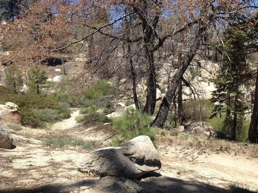
A fire had been through years ago, and you could still see some of the damage, but it got cooler and prettier as we went on.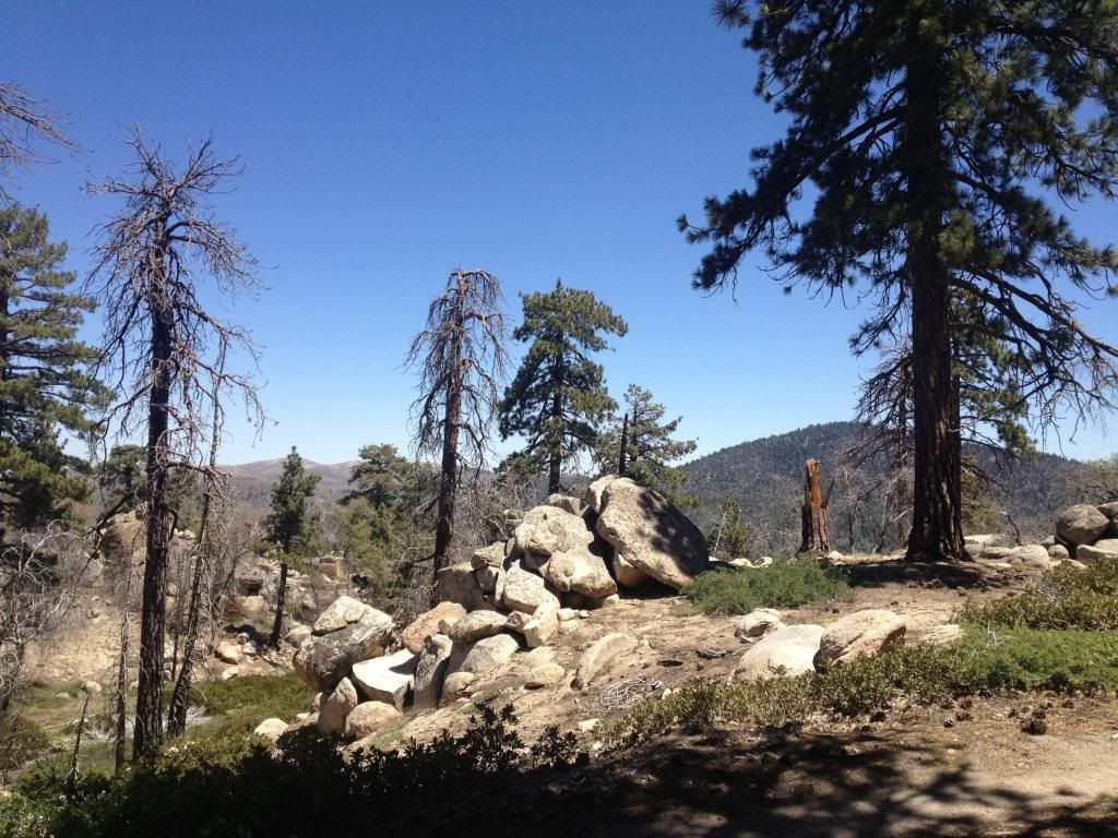
...And the best part...My boyfriend proposed at our bed breakfast the night before. We kept it a secret that day and just enjoyed the hike together.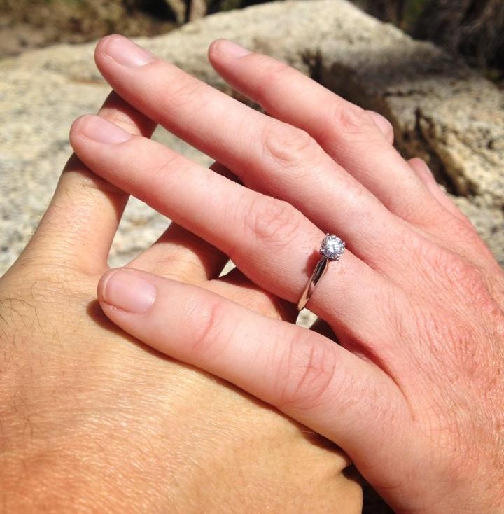
The top was beautiful with a great view of the lake. It was wonderful and peaceful, and I couldn't be happier!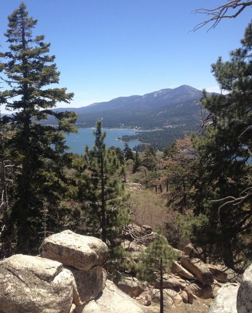
We set a fantastic pace and then ran down the mountain (literally). I'm thinking more and more about getting into trail running. I really loved it.0 -
What an awesome time ! Congratulations on the proposal. Sigh...........a man proposing on the trail is my dream date. So jealous!0
-
Today I did Mount Rose in the Olympic National Forest. 3400 feet in 3 miles to the summit, and of course Mother Nature had to throw in some deep snow in parts, to make it harder to stay on the trail .......um when you could find it. Not to mention that I had 3 YOUNG men hike with me. They were in awesome shape. And flew up the hills. They were so sweet to wait for me with patience. I never did thank them, I was too busy have a stroke Total mile 6.5 miles Round Trip. On the way back we followed the ridge and looped back down the easy way. Yeah right, love to give who ever claimed that myth a good swift kick in the knee caps
My Hiking Team, aka Mountain Goats
Almost to the summit. Breath taking views from here
Lake Chelan

Total Calorie burn 1450 in just under 5 hours.0 -
Here are some pics of us today doing Heart Mountain in Alberta. I take my daughter to almost all my hikes/scrambles but today she got to walk a little on her on for about 30 mins and she even climbed a rock wall with the help of her harness/rope. I was so proud of her, for a 2 year old she did amazing. Once we got back down, I showed her what we had done and she said "wow, can we go again mom?"
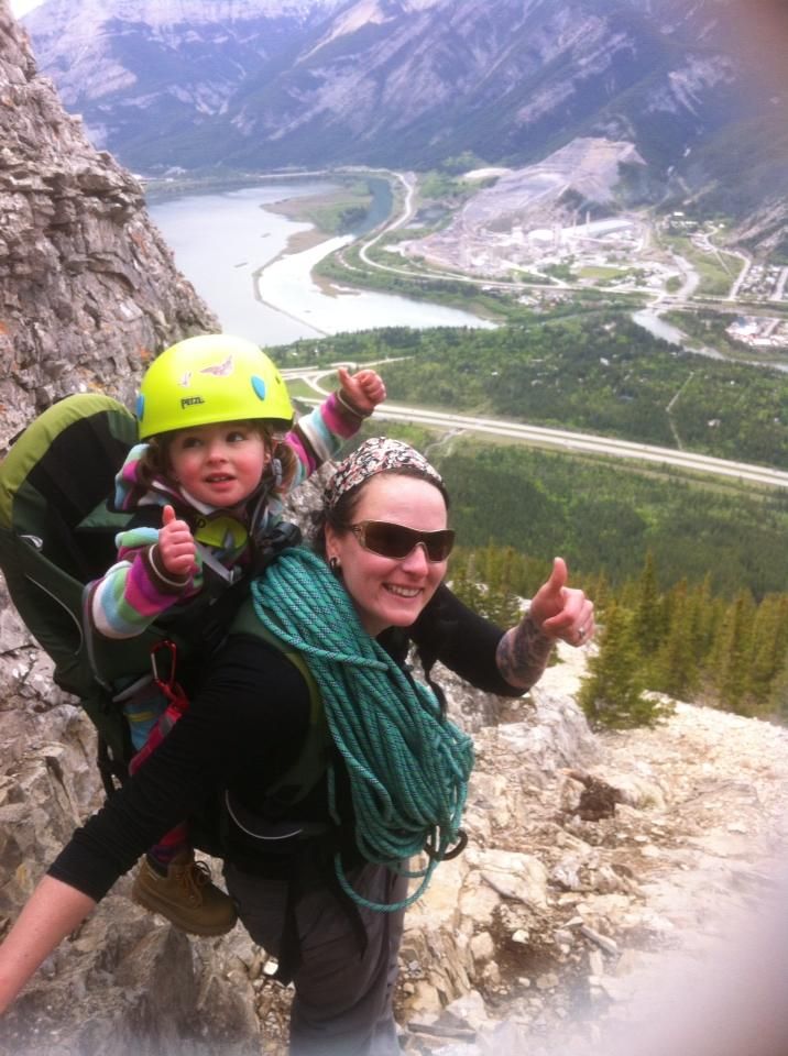
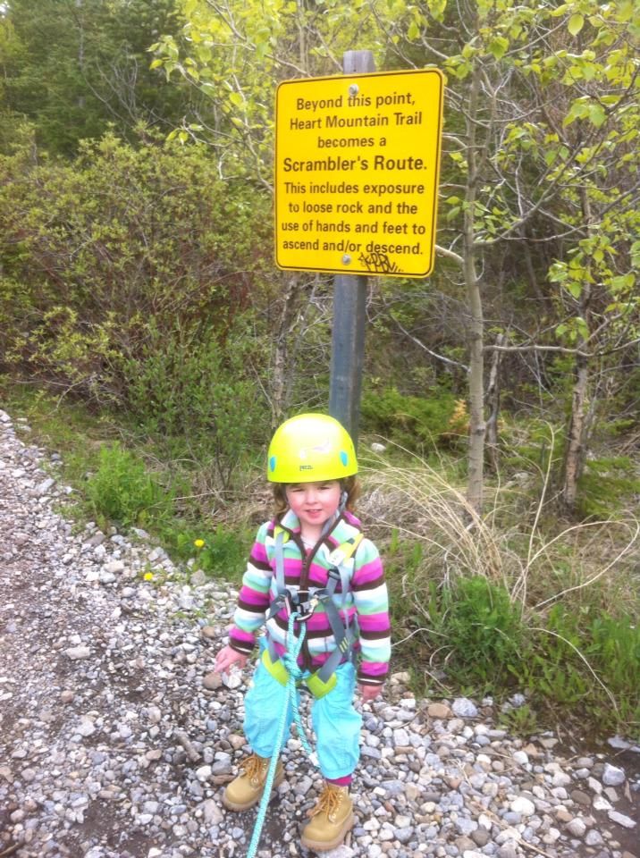 0
0 -
Wow, that looks like some intense terrain. Kudos to you and your daughter.0
-
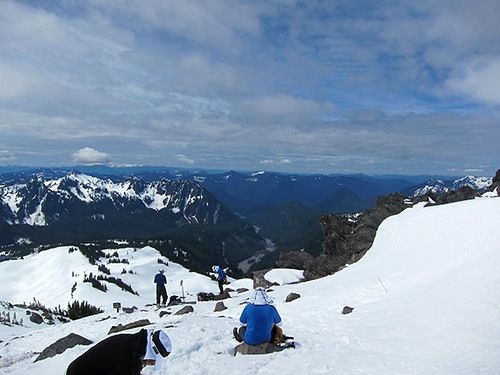
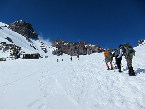
I hiked up to Camp Muir on Mt Rainier yesterday (June 1st) with some friends
...and shot a little movie at the top: http://youtu.be/Qb1Q0Miv5kc
Camp Muir is a climbing hut on Mount Rainer at 10,100 feet.
The hike gained 4680 feet in elevation with a total distance of 9 miles.
With a lot of encouragement from my friends I'm now actually able to do something like this.
Woohoo!!! and thanks to everyone.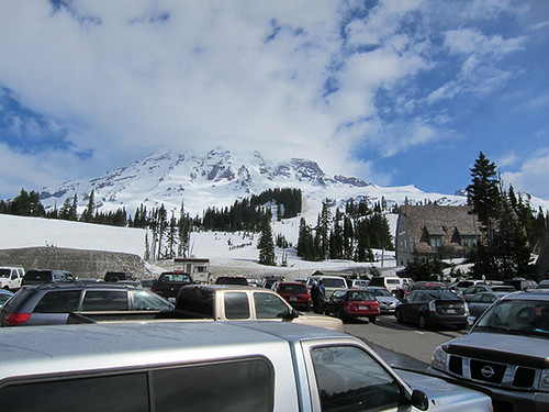
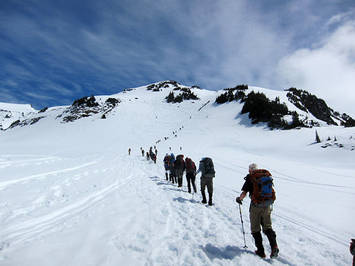

 0
0 -
Awesome pictures Cascade Hiker :drinker: I can't wait for my turn in August. I just might get ants in my pants & head out early before I do Mt Adams.0
-
Oh your pics of Camp Muir makes me want to go back to Rainier.....so BAD!0
-
Today we attempted to do Rooster Mountain, in Snoqualmie WA. We probably only had another 1200 feet to go, but called it, because it was getting too dangerous. No trail no markers, and walking on about 3 feet of snow with run off streaming under the snow below our feet. Total ascent was only 2887 ft. We stopped at a basin and lunch and headed back down. Still a great day and I was able to burn 1348 calories Yay
Snoqualmie River
Tons of little water falls along the way
Almost to the basin
Great picnic spot
Deep snow for miles 0
0 -
I feel like a thread stealer, but I just enjoy sharing my adventures with others.
Today I took some of my non hiking friends with me, so I could get a chance to take a slow hike with my senior dog. We went to Twin Falls in North Bend WA. It's only a 4 mile hike, but very pretty.

My sweet dogs, cooling off in the river
Small streams everywhere, I could just sit there for hours 0
0 -
One of my big hobbies is finding and identifying wildflowers throughout Colorado. Today, I finally found one I've been searching for for awhile. It's hard to find, but so beautiful. It's called the calypso orchid or a fairy slipper.
 0
0 -
Wish we had a "Like" button-- this is so cool!0
-
Wish we had a "Like" button-- this is so cool!
I agree. What a beautiful flower.0 -
@HikerGirl - Twin Falls is one of my favorite "little" hikes. We were there just last week. Great photos.0
-
These weekend we hiked to Goat Lake along Elliot Creek - ten miles round trip - off the Mountain Loop Highway in WA state. Streams and waterfalls were running really high with snowmelt. A beautiful day!
Goat Lake:
McIntosh Falls:
Yellow Violets: 0
0 -
I love that hike. I went on a rainy day last year. Still pretty.0
-
I love calypso orchids, and this is a great shot of the short subtle flowers. John Muir called them "The Hiders of the North," and it's always a thrill to see them in the spring!0
-
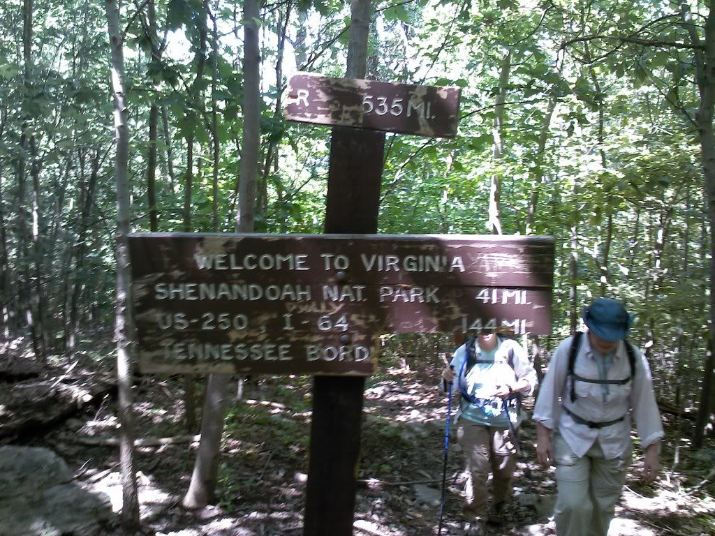
I went on the Appalachian Trail where it crosses the Virginia/West Virginia line, and an adjoining trail, the River To Ridge trail. It was about 11 miles, with lots of up and down and it was glorious! If I can figure out how to post some pix, I will.0
-
I went on the Appalachian Trail where it crosses the Virginia/West Virginia line, and an adjoining trail, the River To Ridge trail. It was about 11 miles, with lots of up and down and it was glorious! If I can figure out how to post some pix, I will.
I use tiny pic.com then at the beginning & end change the img to lower case letters.0 -
Today I took a friend up to Lake Serene out past Gold Bar, Washington. She wanted something challenging yet do - able for her level of hiking. Total calories burned 1419.
First Stop...........Bridal Veil Falls

More falls on the trail
View from the trail
Lake Serene, covered in Snow


HIKER GIRL SAVES THE DAY! Had it not been for my quick response & brute strength this falling log could have been tragic. I managed to catch it and push it off the trail :laugh: 0
0 -
 0
0 -
Today I took a friend up to Lake Serene out past Gold Bar, Washington. She wanted something challenging yet do - able for her level of hiking. Total calories burned 1419.
HIKER GIRL SAVES THE DAY! Had it not been for my quick response & brute strength this falling log could have been tragic. I managed to catch it and push it off the trail :laugh:
LOL. Well done Hiker Girl! Great pics. I hope to do that hike some day.0 -
@FiftySixFit. I used to live farther south along that section of the AT - near Charlottesville, VA. Pretty country!0
-
Yesterday my friend and I headed out for Bandera Mountain. However, when we reached the top we realized we were on the a false summit. People were trying to find the trail but said it was covered with trees. . We are going to try again in the fall, with an earlier start. The weather was perfect and I found a new place to solo backpack with my dog, at Mason lake below the mountain.
One of many views along the trail.
Steep hike up meadow before a slight rock scramble
Side of the trail
Other side of the trail
View from the top
Bear Grass on the way up the alpine meadow
Practicing my Mt Adams summit pose 0
0 -
So green and beautiful Hikergirl! I absolutely LOVE the meadow photo! Don't get me wrong, I love being able to go from mountains to ocean in less than a day, but sometimes I wish I didn't live in a desert.0
-
Re-introduced myself to the Appalachian Trail today. The last time I spent any real time on the trail was nearly 20 years ago. The trail hasn't changed much. The last time I walked I didn't encounter a single person. Today I crossed at least 30 people just out for a walk to one of the lakes or thru hiking. It was great to see people out enjoying the trail.0
-
Here are some videos of my 4-day backpacking trip on the Pemegewasset Loop in New Hampshire's White Mountains.
Day 1 https://www.youtube.com/watch?v=dxFWlB-xZi0
Day 2 https://www.youtube.com/watch?v=blhXv5dJMZ4
Day 3 https://www.youtube.com/watch?v=bkX3Gh92BD0
Day 4 https://www.youtube.com/watch?v=MgX-DZYw2X4 0
This discussion has been closed.


