Anyone doing any hiking?
Replies
-
January 1st 2014 had the day off, so what better way to start the new year?! My friend and her dogs and I all headed for Snoqualmie Pass. We packed our snowshoes but never used them, the snow was packed down quite a bit.. We traveled 7.9 miles with 2390 elevation gain, with views at every turn.


Lower Kendal Peak Lake covered in snow


 0
0 -
Fabulous views, looks like a great time.0
-
Wow, gorgeous! What a beautiful day yesterday was. I especially liked the snowmen/snow dogs picture. Thanks for sharing!0
-
Hikergirl ... those are amazing pictures. Thanks for sharing them and Happy New Year!!0
-
Beautiful! I wish I had gone out yesterday.0
-
This isn't really a true hike (or up to my standards as a hike), but my old dog needed to get out in the woods, and I'm sick of the trails in the dog park. I swear my senior dog was smiling , and my border collie Baxter was thrilled to have his partner in crime by his side. He seems so much happier when she tags along.
Anyway, we went to Ellis Cove in Olympia WA, Lots of trails, and you completely forget that you are in the heart of a City. With all the ups and downs and the steps cut into the hills to prevent erosion, I managed to burn 643 calories in 1 hour and 20 minutes.
First off you must be very watchful for bears

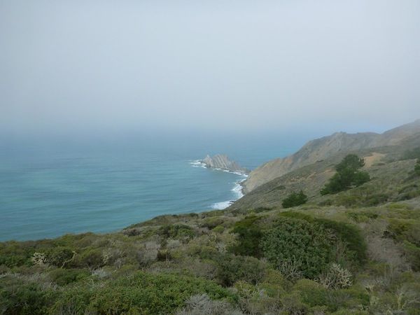
The fog still hadn't lifted when we reached the bay. But I still found a couple of opportunities for some pictures

Jelly fish everywhere
Yes she's smiling
2.3 miles
Of course Baxter is right there to make sure I'm doing what ever I'm doing right. 0
0 -
Wow! That looks like great fun and what a burn! Way to Go!0
-
Love it love it
 0
0 -
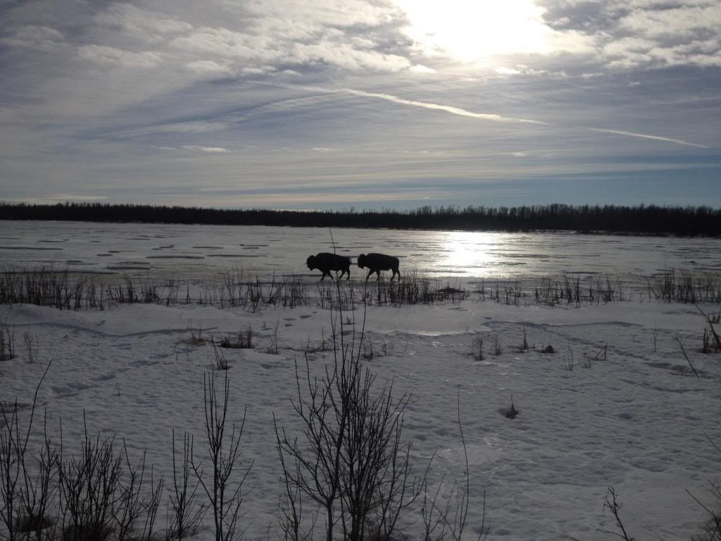
I went hiking with a group along the Shirley trail in Elk Island. The buffalo are out again and we came across two buffalo walking on the lake.0 -
Wow0
-
I am so absolutely jealous!!! What a beautiful hike to be walking with the buffalo. Just amazing!0
-
Ugh so jealous of all the beautiful snow pictures. One of my favorite hikes was up Gorgonio in May in the snow. We're sitting in 80 degree weather here still. No winter for us
 0
0 -
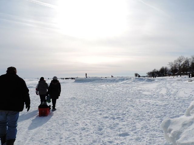
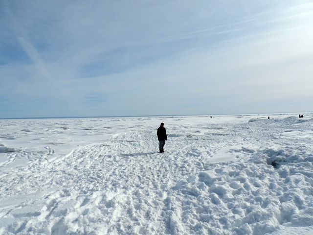
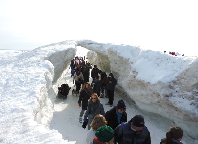
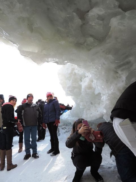
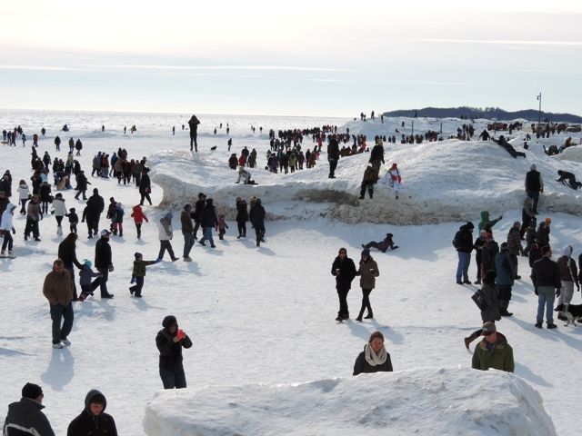
February 17th was Family Day here in Ontario ... Hubby and I went for a little hike at Crystal Beach. With the winter we've had some Ice Caves formed at the beach ... Thousands of people went out this past weekend ... unfortunately, today they were bull dozed down to prevent them from collapsing on anyone. I'm glad we got out to see them. This hasn't happened here since the 1970s
 0
0 -
That's too bad they had to destroy it. Too bad signs or taping it off wouldn't have worked. We have some natural ice caves here, and even with the signs and little fences , people are killed regularly from the falling ice.
Great pictures. I've never been fortunate to see snow on the beach.0 -
Yesterday I needed to get out. We have had such horrible weather. There is only a few places that I go alone this time of year, so once again up Mount Si. The snow and ice on the trail slowed me down, but I still managed to get a 4403 calorie burn in 4 hours & 44 minutes. HRM confirmed. I had planned on scrambling over the rocks to go a little farther but my dogs feet were freezing and noticeably causing him pain, so I fed him and headed down to get him off the ice.


 0
0 -
Great job and beautiful pictures as always hiker girl. I was in Washington for 5 days and it rained non-stop. The snow looks so much prettier than the rain. I'm back in Arizona and hiking often. One of these days I'll learn how to post pictures.0
-
Love those pictures! Thanks for sharing.

During the Family Day Weekend, I went with a hiking group to Jasper National Park. I had a fantastic time! I'm unable to share any pictures I took since I had computer trouble and lost everything. But, here are some pictures that others in the group shared.
Snowshoeing on Horseshoe Lake at Jasper Park.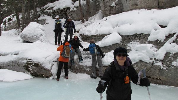
Snowshoeing along Tonquin Valley.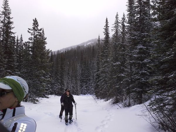
The Maligne Canyon. What a sight, so different from summer time when you see the water flowing.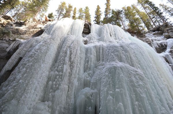
Last day of our trip before heading back to Edmonton we went for a short hike. Took some time for photo's before heading back down.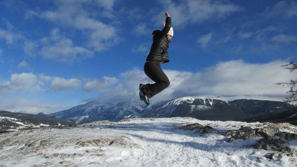
Here is another picture of snowshoeing along Toquin Valley. Can see the water that was to the side of us. I had slipped off the trail once, had to ask the others to wait up while I got myself moving again but luckily at that time there was not any water there.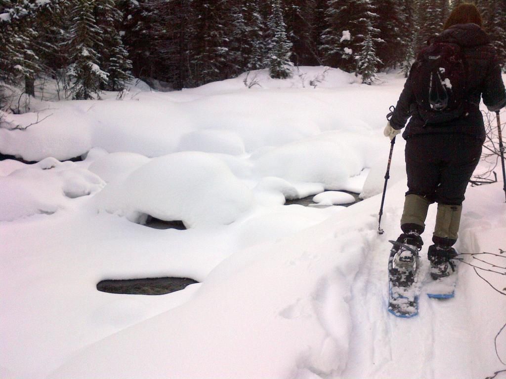 0
0 -
Love those pictures! Thanks for sharing.
During the Family Day Weekend, I went with a hiking group to Jasper National Park. I had a fantastic time! I'm unable to share any pictures I took since I had computer trouble and lost everything. But, here are some pictures that others in the group shared.
Snowshoeing on Horseshoe Lake at Jasper Park.
Snowshoeing along Tonquin Valley.
The Maligne Canyon. What a sight, so different from summer time when you see the water flowing.
Last day of our trip before heading back to Edmonton we went for a short hike. Took some time for photo's before heading back down.
Here is another picture of snowshoeing along Toquin Valley. Can see the water that was to the side of us. I had slipped off the trail once, had to ask the others to wait up while I got myself moving again but luckily at that time there was not any water there.
OMGosh! That frozen waterfall is breath taking. Beautiful pictures0 -
I'm going to try to post a couple of pictures of my hike today in the McDowell Sonoran Preserve in Scottsdale, AZ. This is my go to hiking spot because it is only about a 15 minute drive from my home. There are miles of hikes of varying degrees of difficulty from easy to very strenuous. If I do get some pictures posted it is only due to the help I received from Hikergirl. So here goes. Okay, so it only picked up one of the pictures I thought I had included. It's a start. This is a picture of Tom's Thumb.
 0
0 -
Yay you did it! Wow I haven't been to Arizona in 100 yrs , or at least it feels like it. Early 80's.0
-
I haven't figured out how to post multiple photos . . . yet. I am on the right. Four of us hiked the Tour du Mont Blanc in Europe last August. It's about 105 miles and 3,000 feet elevation gain per day. Very fun, stayed in refuges, dorms or small hotels at night so only carried a large day pack. I highly recommend it. Easy to do the planning yourself with the Cicerone Guide of the Tour du Mont Blanc available thru Amazon.
 0
0 -
Sounds like a wonderful trip! I need to look into that!0
-
I'm going to need a lot more time to get these pictures down pat. These are the ladders that are on a part of the Tour du Mont Blanc hike.
 0
0 -
Just reserved some permits for Mt. Langley in the Sierra Nevada in California (14,026 ft.) Some friends and I are going to climb it this summer. Super excited about this trip. Sometimes the planning/anticipation is half of the fun!0
-
These trips sound amazing ... I love planning them out too, almost as much a going. Those ladders!!! Oh My Word!!!0
-
Hiked the Pedro Point Headlands along the CA coast a couple weekends ago. Although I now have a wicked case of poison oak from it, the hike was beautiful and totally worth it!
The yin-yang of sky/sea and land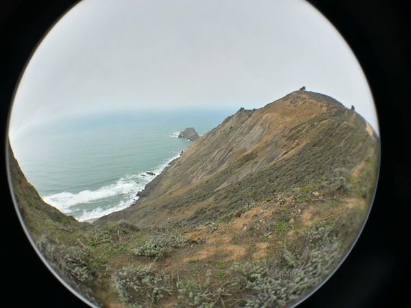
Looking south at Devil's Slide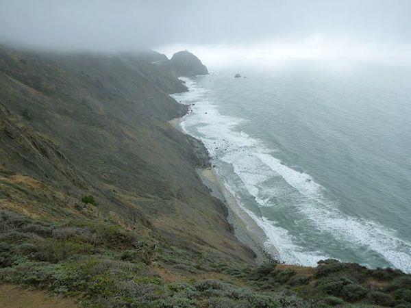
Dominating my friends on the hills - I think this new exercise regime is working! :happy: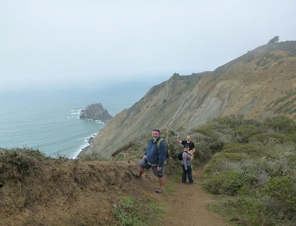 0
0 -
Great photos. So beautiful to have the ocean right next to you!0
-

This is a picture from the start of our hike up to and above Flatiron in the Superstitions. For a good description of the hike or anybody wanting to hike in Arizona, go to HikeArizona.com and look up Flatiron under the "F's". It's only about 3 1/2 miles to the very top, but 2800 ft of elevation gain. The point in the middle of the photo ends up being lower than we go.0 -
Hey gang, hopefully there are some regulars on here. I did one of my favorite trails in St. Louis today called the Lewis Trail. It is 8.2 miles in St. Charles County. The Clark Trail is connected to it and is 5.3 miles. That is the one I usually do. Hope your are all doing well. Joe
This is on the bluff overlooking the Missouri River toward St. Albans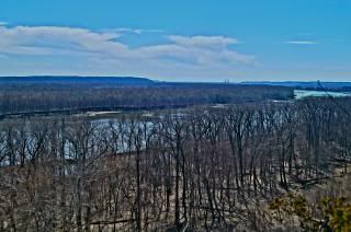 [ 0
[ 0 -
Hey gang, hopefully there are some regulars on here. I did one of my favorite trails in St. Louis today called the Lewis Trail. It is 8.2 miles in St. Charles County. The Clark Trail is connected to it and is 5.3 miles. That is the one I usually do. Hope your are all doing well. Joe
This is on the bluff overlooking the Missouri River toward St. Albans[
Hey Joe - That looks and sounds lovely. I grew up in Illinois near the Mississippi and, although I love where I live now, I do miss the great rivers.
BTW - Where was your profile photo taken?0


This discussion has been closed.