Exercise Report: Virtual Ride Around the Equator Completed
Options

Ejourneys
Posts: 1,603 Member
Last night (Feb. 11, 2017) I completed my Virtual Ride Around the Equator (VRATE). The Earth's circumference around the Equator is approx. 25,000 miles (it's actually 24,901 miles, which I had crossed on Feb. 5, but I rounded it up for my purposes). Last night's workout clocked in at 25,002.4 miles pedaled since Sept. 1, 2012.
That's 1625 days (4 years, 5 months, 11 days), with an average of about 15.4 miles pedaled per day, including rest days.
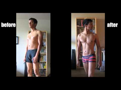
Sept. 1, 2012 had marked the start of my change in eating and exercise habits that led to my losing 51 pounds and arriving at my goal weight in 15 months. I have now maintained that weight for 1154 days (3 years, 1 month, 27 days) as of today.
About a month after I made that change I found this video, made by a guy who had lost 20 pounds by doing a VRATUS: a Virtual Ride Across the United States.
 https://www.youtube.com/watch?v=HdniSABzvFc
I wanted to go longer. Inspired by him, I plotted out my VRATE, which I rode on both a Magne-Trainer and a DeskCycle. I told myself I would aim to complete my journey in time for my 60th birthday.
I completed it at age 58.
I tried to keep as close to the Equator as I could in plotting my route, while still marking my 1,000-mile milestones in an actual place (as opposed, say, to the middle of the ocean). Some milestones are closer to the Equator than others. Several stops are considerably distant from the Equator; a couple are waaaaay off. I had initially intended to blog a mini-travelogue about each "port of call" as I reached it, but that plan fell by the wayside.
My travel itinerary was as follows:
I started from Equatorial coordinates closest to my longitude at home (82.4561° W) and headed west. A degree of longitude is widest at the equator at 69.172 miles. It takes 1000 miles to cover 14.46 degrees of longitude.
My starting point was Cojimies, Ecuador. Latitude: 0.1099936° Longitude: -80.0437596°
Mile 1000 (approx.): Isla Fernandina in the Galapagos: 0°22′S 91°33′W -- I don’t have a date of arrival here because I had already passed this point when I decided to do the VRATE.
Mile 2000 (approx.): Easter Island 27.1167° S, 109.3667° W, reached on 3/17/13
Mile 3000 (approx.): Vancouver BC 49° 15' 0" N / 123° 8' 0" W (as I said, waaaaaay off the Equator!), reached on 8/28/13
Mile 4000 (approx.): Marquesas Islands 9º 00S, 139º 30W, reached on 11/17/2013
Mile 5000 (approx.): Austral Islands 23.0000° S, 150.0000° W, reached on 1/27/2014
Mile 6000 (approx.): Samoa 13°50'S 171°50'W (technically I had gone about 345 mi past Samoa), reached on 4/8/2014
I had reached Samoa after my cancer diagnosis and lumpectomy. I made the following ports of call while undergoing chemo.
Mile 7000 (approx.): Fiji at 18.1667° S, 178.4500° E (crossed the International Date Line!), reached on 6/9/2014
Mile 8000 (approx.): Republic of Nauru 0.5273° S, 166.9367° E, reached on 8/1/14
Mile 9000 (approx.): St. Matthias Group in Papua New Guinea 1.5833° S, 149.8167°, reached on 9/23/14
I finished chemo about halfway between the St. Matthias Group and Puncak Jaya, which I reached while undergoing radiation.
Mile 10000 (approx.): Puncak Jaya, Indonesia (mountain) 4.0833° S, 137.1833° E, reached on 11/15/14
Mile 11000 (approx.): Palu, Indonesia 0°54′S 119°50′E, reached on 1/3/15
Mile 12000 (approx.): Pangkal Pinang, Indonesia 2°8′S 106°7′E, reached on 2/28/15
Mile 13000 (approx.): Tripura, India 23.84°N 91.28°E, reached on 4/22/15
Mile 14000 (approx.): Nagercoli in Tamil Nadu, India 8.17°N 77.43°E, reached on 6/11/15
Mile 15000 (approx.): Rodrigues Island (dependency of Mauritius), 19°43′S 63°25′E, reached on 8/12/15
Mile 16000 (approx.): Marotandrano, Madagascar 16° 10′ 00″ S 48° 50′ 00″ E, reached on 10/21/15
Mile 17000 (approx.): Kisii, Kenya 0°41′S 34°46′E, reached on 12/13/15
I was hospitalized for a chemo port-associated blood clot about halfway between Kisii and Kaga-Bandoro and was on blood thinners (and wearing a compression sleeve for venous swelling) until I was about halfway between Benin City and River Cess.
Mile 18000 (approx.): Kaga-Bandoro, Central African Republic 7°0′N 19°11′E, reached on 2/3/16
Mile 19000 (approx.): Benin City, Nigeria 6°19′N 5°36′E, reached on 3/18/16
Mile 20000 (approx.): River Cess, Liberia 5°28′N 9°35′W, reached on 5/10/16
Mile 21000 (approx.): Santa Maria Island, Azores 36°58′58″N 25°5′27″W, reached on 7/9/16
Mile 22000 (approx.): Salvador, Brazil 12°58′29″S 38°28′36″W, reached on 9/3/16
Mile 23000 (approx.): Pelotas, Brazil 31°46′19″S 52°20′33″W, reached on 10/26/16
Mile 24000 (approx.): Puerto Ayacucho, Venezuela 5.5944° N, 67.6969° W, reached on 12/16/16
Mile 25000 (approx.): back to Cojimies and HOME, reached on 2/11/17
So, where to from here? I think I'll head north along my longitude line (or as close to it as I can stay) and do a pole-to-pole. While the ice is still there. Stay tuned.
That's 1625 days (4 years, 5 months, 11 days), with an average of about 15.4 miles pedaled per day, including rest days.
Sept. 1, 2012 had marked the start of my change in eating and exercise habits that led to my losing 51 pounds and arriving at my goal weight in 15 months. I have now maintained that weight for 1154 days (3 years, 1 month, 27 days) as of today.
About a month after I made that change I found this video, made by a guy who had lost 20 pounds by doing a VRATUS: a Virtual Ride Across the United States.
https://www.youtube.com/watch?v=HdniSABzvFcI wanted to go longer. Inspired by him, I plotted out my VRATE, which I rode on both a Magne-Trainer and a DeskCycle. I told myself I would aim to complete my journey in time for my 60th birthday.
I completed it at age 58.
I tried to keep as close to the Equator as I could in plotting my route, while still marking my 1,000-mile milestones in an actual place (as opposed, say, to the middle of the ocean). Some milestones are closer to the Equator than others. Several stops are considerably distant from the Equator; a couple are waaaaay off. I had initially intended to blog a mini-travelogue about each "port of call" as I reached it, but that plan fell by the wayside.
My travel itinerary was as follows:
I started from Equatorial coordinates closest to my longitude at home (82.4561° W) and headed west. A degree of longitude is widest at the equator at 69.172 miles. It takes 1000 miles to cover 14.46 degrees of longitude.
My starting point was Cojimies, Ecuador. Latitude: 0.1099936° Longitude: -80.0437596°
Mile 1000 (approx.): Isla Fernandina in the Galapagos: 0°22′S 91°33′W -- I don’t have a date of arrival here because I had already passed this point when I decided to do the VRATE.
Mile 2000 (approx.): Easter Island 27.1167° S, 109.3667° W, reached on 3/17/13
Mile 3000 (approx.): Vancouver BC 49° 15' 0" N / 123° 8' 0" W (as I said, waaaaaay off the Equator!), reached on 8/28/13
Mile 4000 (approx.): Marquesas Islands 9º 00S, 139º 30W, reached on 11/17/2013
Mile 5000 (approx.): Austral Islands 23.0000° S, 150.0000° W, reached on 1/27/2014
Mile 6000 (approx.): Samoa 13°50'S 171°50'W (technically I had gone about 345 mi past Samoa), reached on 4/8/2014
I had reached Samoa after my cancer diagnosis and lumpectomy. I made the following ports of call while undergoing chemo.
Mile 7000 (approx.): Fiji at 18.1667° S, 178.4500° E (crossed the International Date Line!), reached on 6/9/2014
Mile 8000 (approx.): Republic of Nauru 0.5273° S, 166.9367° E, reached on 8/1/14
Mile 9000 (approx.): St. Matthias Group in Papua New Guinea 1.5833° S, 149.8167°, reached on 9/23/14
I finished chemo about halfway between the St. Matthias Group and Puncak Jaya, which I reached while undergoing radiation.
Mile 10000 (approx.): Puncak Jaya, Indonesia (mountain) 4.0833° S, 137.1833° E, reached on 11/15/14
Mile 11000 (approx.): Palu, Indonesia 0°54′S 119°50′E, reached on 1/3/15
Mile 12000 (approx.): Pangkal Pinang, Indonesia 2°8′S 106°7′E, reached on 2/28/15
Mile 13000 (approx.): Tripura, India 23.84°N 91.28°E, reached on 4/22/15
Mile 14000 (approx.): Nagercoli in Tamil Nadu, India 8.17°N 77.43°E, reached on 6/11/15
Mile 15000 (approx.): Rodrigues Island (dependency of Mauritius), 19°43′S 63°25′E, reached on 8/12/15
Mile 16000 (approx.): Marotandrano, Madagascar 16° 10′ 00″ S 48° 50′ 00″ E, reached on 10/21/15
Mile 17000 (approx.): Kisii, Kenya 0°41′S 34°46′E, reached on 12/13/15
I was hospitalized for a chemo port-associated blood clot about halfway between Kisii and Kaga-Bandoro and was on blood thinners (and wearing a compression sleeve for venous swelling) until I was about halfway between Benin City and River Cess.
Mile 18000 (approx.): Kaga-Bandoro, Central African Republic 7°0′N 19°11′E, reached on 2/3/16
Mile 19000 (approx.): Benin City, Nigeria 6°19′N 5°36′E, reached on 3/18/16
Mile 20000 (approx.): River Cess, Liberia 5°28′N 9°35′W, reached on 5/10/16
Mile 21000 (approx.): Santa Maria Island, Azores 36°58′58″N 25°5′27″W, reached on 7/9/16
Mile 22000 (approx.): Salvador, Brazil 12°58′29″S 38°28′36″W, reached on 9/3/16
Mile 23000 (approx.): Pelotas, Brazil 31°46′19″S 52°20′33″W, reached on 10/26/16
Mile 24000 (approx.): Puerto Ayacucho, Venezuela 5.5944° N, 67.6969° W, reached on 12/16/16
Mile 25000 (approx.): back to Cojimies and HOME, reached on 2/11/17
So, where to from here? I think I'll head north along my longitude line (or as close to it as I can stay) and do a pole-to-pole. While the ice is still there. Stay tuned.
6
Replies
-
Well done! You should post this in "Success Stories", too, if you haven't already. Great accomplishment - and during cancer treatment, too. Having gone through surgery/chemo/radiation a few years back myself, I know that's no walk in the park . . . let alone pedaling around the world at the same time!
") 2
2 -
Congratulations! It's amazing that you managed to do all that with the health issues you had.
This looks like a really fun idea.1 -
Wow. That's amazing, well done.
Now I want to do this . . .") 0
0


Categories
- All Categories
- 1.4M Health, Wellness and Goals
- 391.3K Introduce Yourself
- 43.4K Getting Started
- 259.6K Health and Weight Loss
- 175.6K Food and Nutrition
- 47.3K Recipes
- 232.3K Fitness and Exercise
- 387 Sleep, Mindfulness and Overall Wellness
- 6.4K Goal: Maintaining Weight
- 8.5K Goal: Gaining Weight and Body Building
- 152.7K Motivation and Support
- 7.8K Challenges
- 1.3K Debate Club
- 96.2K Chit-Chat
- 2.5K Fun and Games
- 3.2K MyFitnessPal Information
- 22 News and Announcements
- 913 Feature Suggestions and Ideas
- 2.3K MyFitnessPal Tech Support Questions