We are pleased to announce that on March 4, 2025, an updated Rich Text Editor will be introduced in the MyFitnessPal Community. To learn more about the upcoming changes, please click here. We look forward to sharing this new feature with you!
3 Summits (pics)
NorthCascades
Posts: 10,968 Member
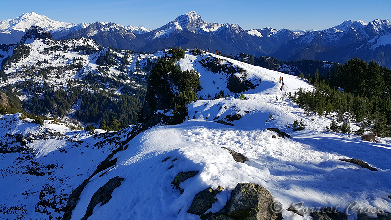
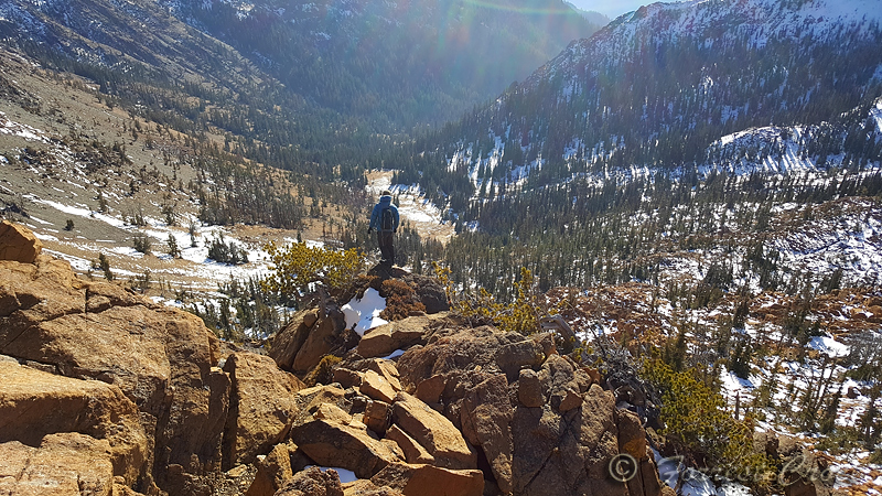
On Saturday, my friend Mary and I met at a park and ride, and drove off to a section of the northern Cascades called the "mountain loop" together, to finally hike Mount Dickerman. This has been on both of our lists for years. It was worth the wait. It's not every day you get to look down on Forgotten and Big Four, and there are ice peaks as far as the eye can see.
Dickerman is a walk up peak; you can get to the summit with your hands in your pockets. But the trail gains 4,000 feet of elevation over the course of about 4 miles.
https://connect.garmin.com/modern/activity/3168235827
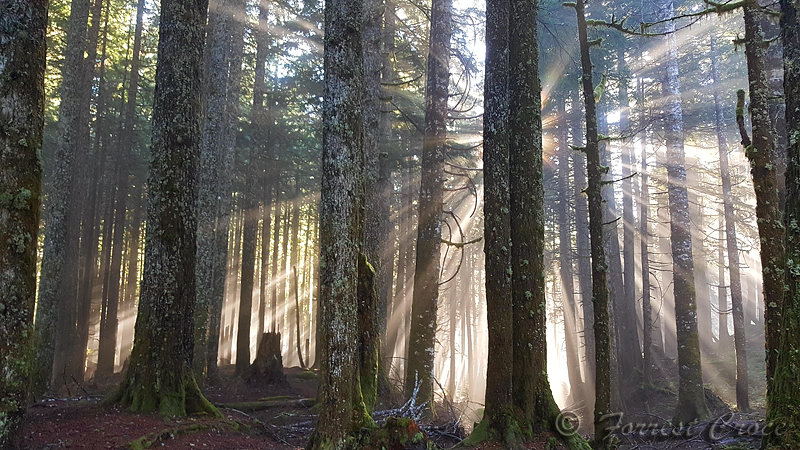
Most Cascades hikes start out looking like this.
The trail finally breaks out of the woods a little beyond half way. There's a lovely meadow with sublime views.
Big Four on the left, Pilchuck in the background.
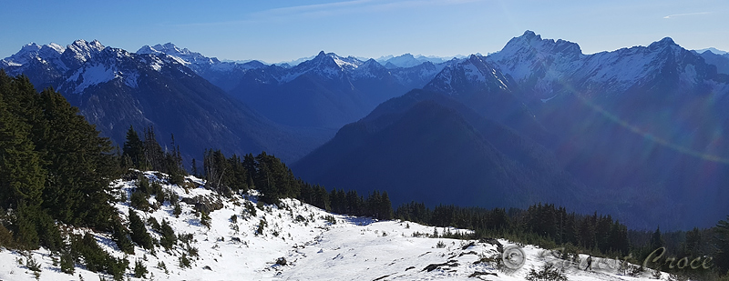
View from the top, Glacier Peak on the left.
Glacier, Forgotten, and Sloan behind me.

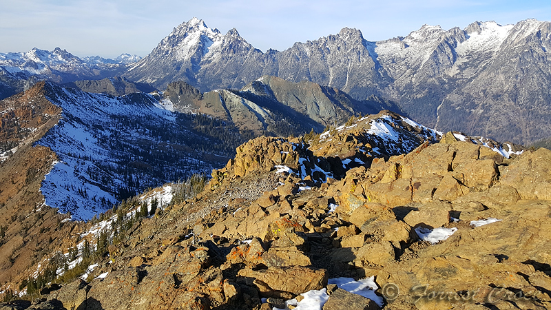
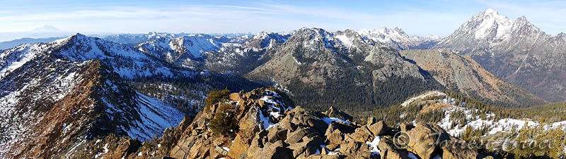
On Tuesday, my friend Nick and I got up before dawn and drove out to the Teanaway together to see what trouble we could get into. Another friend had sent me incredible pictures from Bean Creek Basin, and a photo is worth a thousand miles.
We followed a trail to a lovely meadow with a snowy headwall. This would be a fantastic place to camp. From here we basically went up the fall line until we topped out on the ridge. Amazing view of the whole range, and the lay of the land.
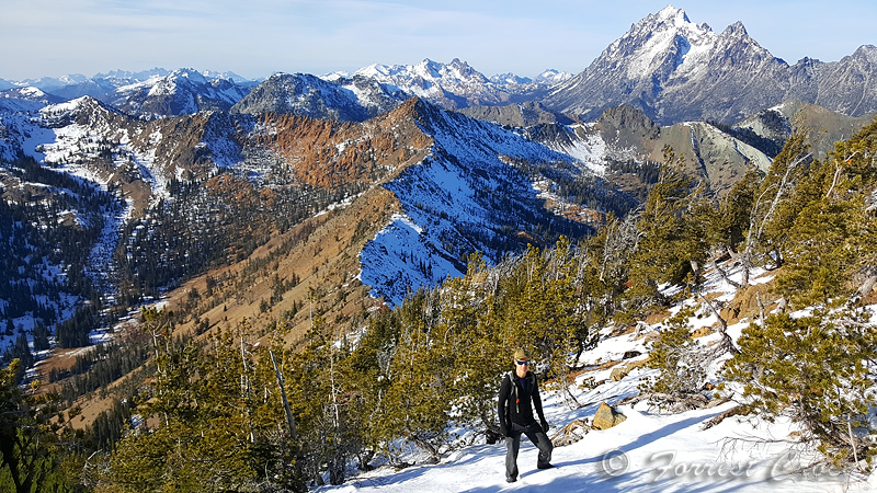
We tagged Bean first, ran the ridge, and bagged Earl. Earl is a walk up, Bean is a technical scramble. Very straightforward and easy, with some exposure. The crux moves come on the way back down, with nothing but 300 feet of air below you, again, pretty easy stuff, there's no reason to fall.
This wound up being 4,200 feet of vert over 9 miles.
https://connect.garmin.com/modern/activity/3175065728
From Earl Peak. Bean is on the left, its north face dusted with snow. In the background: Stuart, Sherpa, Argonaut, Colchuck, and Dragontail.
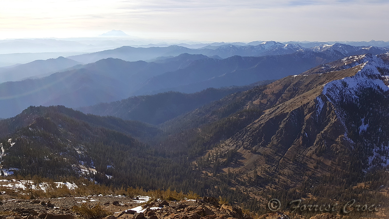
Lot of haze looking south at Rainier. Adams was faintly visible from here, but didn't show up in pictures.
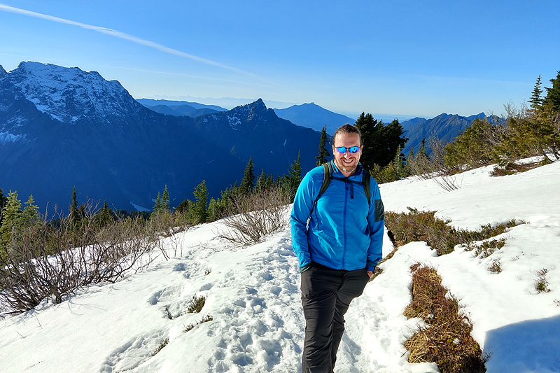
Nick making his way up toward the second summit. Stuart, Ingalls, Bean behind.
Nick looking down at the basin from whence we came.
Summit pano.
Colchuck, Dragontail, Little Annapurna, McClellan.

Dickerman is a walk up peak; you can get to the summit with your hands in your pockets. But the trail gains 4,000 feet of elevation over the course of about 4 miles.
https://connect.garmin.com/modern/activity/3168235827
Most Cascades hikes start out looking like this.
The trail finally breaks out of the woods a little beyond half way. There's a lovely meadow with sublime views.
Big Four on the left, Pilchuck in the background.
View from the top, Glacier Peak on the left.
Glacier, Forgotten, and Sloan behind me.
On Tuesday, my friend Nick and I got up before dawn and drove out to the Teanaway together to see what trouble we could get into. Another friend had sent me incredible pictures from Bean Creek Basin, and a photo is worth a thousand miles.
We followed a trail to a lovely meadow with a snowy headwall. This would be a fantastic place to camp. From here we basically went up the fall line until we topped out on the ridge. Amazing view of the whole range, and the lay of the land.
We tagged Bean first, ran the ridge, and bagged Earl. Earl is a walk up, Bean is a technical scramble. Very straightforward and easy, with some exposure. The crux moves come on the way back down, with nothing but 300 feet of air below you, again, pretty easy stuff, there's no reason to fall.
This wound up being 4,200 feet of vert over 9 miles.
https://connect.garmin.com/modern/activity/3175065728
From Earl Peak. Bean is on the left, its north face dusted with snow. In the background: Stuart, Sherpa, Argonaut, Colchuck, and Dragontail.
Lot of haze looking south at Rainier. Adams was faintly visible from here, but didn't show up in pictures.
Nick making his way up toward the second summit. Stuart, Ingalls, Bean behind.
Nick looking down at the basin from whence we came.
Summit pano.
Colchuck, Dragontail, Little Annapurna, McClellan.
13
Replies
-
Wow!1
-
Wish i had places like that to go.
nice!2 -
So beautiful. What fun too1
-
Awesome!1
-
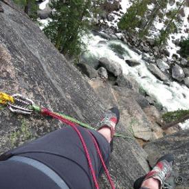
Not sure if this will work, but here's a pic of me trudging my way up.
Sketchy crossing early on, everything covered in frost or ice.1 -
Oooh like the teeny waterfall. I love waterfalls1
-
You guys are SO lucky to live close to hikes like that. Wow, amazing pictures of what - I imagine - must've been even more amazing views in person!1
-
Great day!1


This discussion has been closed.
Categories
- All Categories
- 1.4M Health, Wellness and Goals
- 394.3K Introduce Yourself
- 44K Getting Started
- 260.4K Health and Weight Loss
- 176.1K Food and Nutrition
- 47.5K Recipes
- 232.7K Fitness and Exercise
- 440 Sleep, Mindfulness and Overall Wellness
- 6.5K Goal: Maintaining Weight
- 8.6K Goal: Gaining Weight and Body Building
- 153.1K Motivation and Support
- 8.1K Challenges
- 1.3K Debate Club
- 96.4K Chit-Chat
- 2.5K Fun and Games
- 4K MyFitnessPal Information
- 16 News and Announcements
- 1.2K Feature Suggestions and Ideas
- 2.7K MyFitnessPal Tech Support Questions