We are pleased to announce that as of March 4, 2025, an updated Rich Text Editor has been introduced in the MyFitnessPal Community. To learn more about the changes, please click here. We look forward to sharing this new feature with you!
Mount San Antonio (aka Mt Baldy) #13/18

cheriej2042
Posts: 241 Member
Mount San Antonio at 10,066 ft is the high point of the San Gabriel mountain range, the county and metro Los Angeles area. A popular peak, most hikers refer to it solely by “mt Baldy” which was a name given to it by American settlers to describe the bare Baldy Bowl face that faces south towards LA.
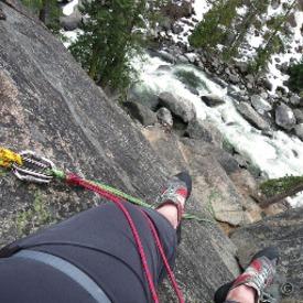
With snow coming Monday down to 5000ft I knew I had to hike this peak this week. There are a number of ways to summit Baldy and I’ve done the long Bear Canyon trail already. Today I decided to do what I call the “classic route” starting on the Baldy Bowl trail and hiking up past the Sierra Club ski hut. This trail starts higher at 6,160 but still has 3,904 of elevation gain. Coming down I continued the loop down the famous Devils Backbone where I’ve heard of hikers frozen with fear of the narrow trail.
Total mileage was 10.34. Starting out I was thrilled to see I was above the clouds.


Then I could see the Baldy Bowl as I made my way towards the ski hut. The hut was closed which was disappointing as I could have used a nap.


After this the trail became very steep up through a pine forest and then to the summit. I struggled here but just took it slow. On the weekends hundreds come up this trail so I was glad to only see one person on the way up.


It’s windy at the summit so I decided to not stop and made my way to the devils backbone trail. I ran into a hiker coming from there and he told me that he was scared coming up and how narrow it was. I looked over the edge and saw a trail way up on a ridge, which looked really sketchy, but then I saw a trail to the right further down the slope. The hiker told me the lower trail was the backbone. Well that turned out to be a bit disappointing. It wasn’t that difficult.


Finally as I made my way towards the notch with the ski lift/restaurant (all closed) the clouds came up and it was much colder all the way down.

I underestimated this hike. It was more difficult than I thought but glad I finally got to do it and without the crowds.
With snow coming Monday down to 5000ft I knew I had to hike this peak this week. There are a number of ways to summit Baldy and I’ve done the long Bear Canyon trail already. Today I decided to do what I call the “classic route” starting on the Baldy Bowl trail and hiking up past the Sierra Club ski hut. This trail starts higher at 6,160 but still has 3,904 of elevation gain. Coming down I continued the loop down the famous Devils Backbone where I’ve heard of hikers frozen with fear of the narrow trail.
Total mileage was 10.34. Starting out I was thrilled to see I was above the clouds.
Then I could see the Baldy Bowl as I made my way towards the ski hut. The hut was closed which was disappointing as I could have used a nap.
After this the trail became very steep up through a pine forest and then to the summit. I struggled here but just took it slow. On the weekends hundreds come up this trail so I was glad to only see one person on the way up.
It’s windy at the summit so I decided to not stop and made my way to the devils backbone trail. I ran into a hiker coming from there and he told me that he was scared coming up and how narrow it was. I looked over the edge and saw a trail way up on a ridge, which looked really sketchy, but then I saw a trail to the right further down the slope. The hiker told me the lower trail was the backbone. Well that turned out to be a bit disappointing. It wasn’t that difficult.
Finally as I made my way towards the notch with the ski lift/restaurant (all closed) the clouds came up and it was much colder all the way down.
I underestimated this hike. It was more difficult than I thought but glad I finally got to do it and without the crowds.
3
Replies
-
I've done that hike, super fun!1
-
Beautiful pictures. Glad you got to enjoy it.
1 -
I love the fog blowing in below you, with the lesser peaks looking like islands. 🙂1
-
Man, those are some stunning images.
Well done.0


Categories
- All Categories
- 1.4M Health, Wellness and Goals
- 394.6K Introduce Yourself
- 44K Getting Started
- 260.5K Health and Weight Loss
- 176.1K Food and Nutrition
- 47.5K Recipes
- 232.7K Fitness and Exercise
- 444 Sleep, Mindfulness and Overall Wellness
- 6.5K Goal: Maintaining Weight
- 8.6K Goal: Gaining Weight and Body Building
- 153.1K Motivation and Support
- 8.1K Challenges
- 1.3K Debate Club
- 96.4K Chit-Chat
- 2.5K Fun and Games
- 4.1K MyFitnessPal Information
- 16 News and Announcements
- 1.3K Feature Suggestions and Ideas
- 2.8K MyFitnessPal Tech Support Questions