We are pleased to announce that as of March 4, 2025, an updated Rich Text Editor has been introduced in the MyFitnessPal Community. To learn more about the changes, please click here. We look forward to sharing this new feature with you!
Google Earth is cool

BenKnowsFitness
Posts: 451 Member
I ran 400 miles this year and have lost just a few pounds. Last year I ran 275 miles and lost over 70 pounds. Eating has not changed much either. But it's ok!!!! I am happy as can be with the new me. Look at the plot of my favorite run below. I used iphone gps data with google earth to make it.

[/quote]
[/quote]
0
Replies
-
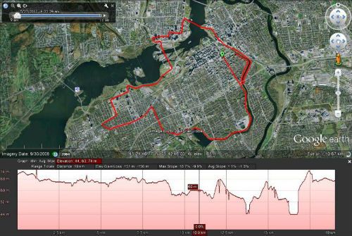
I have fun with Google Earth too, the Garmin Training Center software can export your GPS co-ordinates and give you a great representation of you run, bike ride etc.
eg, here's a half marathon from last May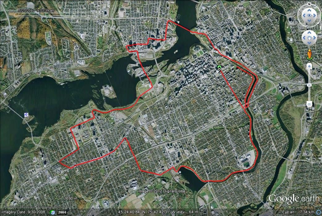
(sorry, don't know how to re-size the image for MFP)0 -
That is cool. I suppose you know that if you right click on your path that you can pull up the elevation profile. I'd love to see the one for the your course.I have fun with Google Earth too, the Garmin Training Center software can export your GPS co-ordinates and give you a great representation of you run, bike ride etc.
eg, here's a half marathon from last May
(sorry, don't know how to re-size the image for MFP)0 -
Here you go (I resized the image using photobucket's editor)
 0
0 -
I can see all my kids' crap in the yard from orbit....nice....:grumble:0
-
Here you go (I resized the image using photobucket's editor)
That little chunk at the end looks like rock climbing... 0
0 -
It looks worse than it really was, the low section is a bridge crossing the river back into Ottawa then coming up to Sussex Dr (total elevation gain is only about 20m but the scale compresses it)0
-
I use walkjogrun.com
it's cool.0 -
That is cool!!0


This discussion has been closed.
Categories
- All Categories
- 1.4M Health, Wellness and Goals
- 391.5K Introduce Yourself
- 43.5K Getting Started
- 259.7K Health and Weight Loss
- 176.1K Food and Nutrition
- 47.5K Recipes
- 232.3K Fitness and Exercise
- 392 Sleep, Mindfulness and Overall Wellness
- 6.4K Goal: Maintaining Weight
- 8.5K Goal: Gaining Weight and Body Building
- 152.7K Motivation and Support
- 7.8K Challenges
- 1.3K Debate Club
- 96.3K Chit-Chat
- 2.5K Fun and Games
- 4K MyFitnessPal Information
- 22 News and Announcements
- 926 Feature Suggestions and Ideas
- 2.7K MyFitnessPal Tech Support Questions