Walking nature trails is my FAVORITE exercise!
Replies
-
To the OP: watch out, you start with dayhikes on easy trails, continue with all day hikes, then overnight hikes, and before you know it, you're hiking the AT, PCT and CDT. It can be very addictive, spending time on trails.3
-
Well, it may not be as spectacular as where you lot are, but here's a nice sample photo from yesterday's 15-miler: the ruined abbey at Tintern, as seen from the Devil's Pulpit on the other side of the Wye
")

7 -
It's my favorite too!
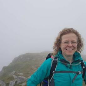
When we feel like going to the pub but I don't have the calories for a beer, we pick a country pub to walk to and walk there and back to earn it. I've lost over 30 pounds without giving up anything I like because of these walks!3 -
spiriteagle99 wrote: »To the OP: watch out, you start with dayhikes on easy trails, continue with all day hikes, then overnight hikes, and before you know it, you're hiking the AT, PCT and CDT. It can be very addictive, spending time on trails.
The AT fascinates me! (As do any/all long hikes like it). I have done a 1.2 mile stretch of it, that’s about it. I met a gentleman at the river and he had the AT tattooed down one side of his back (I have read enough books and looked at enough maps to know it almost as soon as I saw it), so I asked him about it... he has thru-hiked it three times! I don’t know if I could ever hike it all at once for a variety of reasons, but I would love to do section by section someday.
2 -
cwolfman13 wrote: »La Luz Trail in Albuquerque is one of my favorite local hikes.

It's about 7.5 miles up with 3200 ft of elevation gain and then another 7.5 miles down though many, including myself often opt to take the Tram down from the crest.
Unfortunately, as one of the most popular trails in the area, it is often frequented by tourists who are not accustomed to the elevation as you start at a little over 7,000 feet and end at the crest at over 10,000 feet. Rescues are pretty regular occurrences. A lot of times people aren't dressed or prepared with proper clothing...it can be quite warm and comfortable in the foothills with lots of sunshine in the high desert portion, but it gets colder and more shaded by forest as you climb. It can easily be 60*F at the bottom and below freezing on the crest with ripping winds.
It's actually a great hike to do in mid summer if you start early when it's still cool out...you can stay comfortable most of the day. We've done it in May and had to turn around with the last 3 miles or so in front of us because it was getting too snow packed and icy to continue safely. Turns out there were three rescues that day due to people trying to get through the snow.
We plan to be in Albuquerque in mid-June - how do we find this trail? Doubt we would go all the way up, probably just to 8500' or so, but would love to see part of that area!0 -
I will start traveling to New Mexico next year for work. I will find this trail!!!1
-
MikePfirrman wrote: »cwolfman13 wrote: »La Luz Trail in Albuquerque is one of my favorite local hikes.
It's about 7.5 miles up with 3200 ft of elevation gain and then another 7.5 miles down though many, including myself often opt to take the Tram down from the crest.
Unfortunately, as one of the most popular trails in the area, it is often frequented by tourists who are not accustomed to the elevation as you start at a little over 7,000 feet and end at the crest at over 10,000 feet. Rescues are pretty regular occurrences. A lot of times people aren't dressed or prepared with proper clothing...it can be quite warm and comfortable in the foothills with lots of sunshine in the high desert portion, but it gets colder and more shaded by forest as you climb. It can easily be 60*F at the bottom and below freezing on the crest with ripping winds.
It's actually a great hike to do in mid summer if you start early when it's still cool out...you can stay comfortable most of the day. We've done it in May and had to turn around with the last 3 miles or so in front of us because it was getting too snow packed and icy to continue safely. Turns out there were three rescues that day due to people trying to get through the snow.
Being very new to SW hiking, it's quite remarkable, to me, how hard it can be walking on totally rocky trails. Looking at that picture, it shows how rocky the trails can be. It's just a totally different type of trail. I can't imagine doing 15 miles on that stuff.
Fortunately, that is only a small portion of the trail known as the "rock slide." Most of the trail is much easier to walk on. What gets most people is the grade, even with switchbacks it's pretty steep...and then the elevation...the air is thin in Albuquerque...and then you add a few more thousand feet to the crest1 -
Mine too along with Mountain Biking1
-
jim_pipkin wrote: »cwolfman13 wrote: »La Luz Trail in Albuquerque is one of my favorite local hikes.
It's about 7.5 miles up with 3200 ft of elevation gain and then another 7.5 miles down though many, including myself often opt to take the Tram down from the crest.
Unfortunately, as one of the most popular trails in the area, it is often frequented by tourists who are not accustomed to the elevation as you start at a little over 7,000 feet and end at the crest at over 10,000 feet. Rescues are pretty regular occurrences. A lot of times people aren't dressed or prepared with proper clothing...it can be quite warm and comfortable in the foothills with lots of sunshine in the high desert portion, but it gets colder and more shaded by forest as you climb. It can easily be 60*F at the bottom and below freezing on the crest with ripping winds.
It's actually a great hike to do in mid summer if you start early when it's still cool out...you can stay comfortable most of the day. We've done it in May and had to turn around with the last 3 miles or so in front of us because it was getting too snow packed and icy to continue safely. Turns out there were three rescues that day due to people trying to get through the snow.
We plan to be in Albuquerque in mid-June - how do we find this trail? Doubt we would go all the way up, probably just to 8500' or so, but would love to see part of that area!
@jim_pipkin
There are a couple of options here. From I-25 you would take the Tramway exit and head east towards the mountains and turn onto forest road 333. Continue on FR 333 until you see signage for Juan Tabo Picnic Area and La Luz Trail...this will take you to the parking lot and the trail head. Just put in Juan Tabo Picnic Site into your GPS...it's easy to find.
Alternatively, you can start the hike from the base of the Sandia Tram...there is a trail there that connects with La Luz. The trail is about 2.5 miles and meets up with the La Luz trail about 2 miles up from the parking lot and trail head. A lot of people opt for this option because they hike up and take the Tram back down. If you take this trail, note that it has a history of being re-routed so parts of the old trail system can sometimes confuse visitors...the main trail is well worn though and the older parts not so much, so it's not that difficult to stay on the main trail.
There is a new restaurant that just opened at the crest called Ten 3...I haven't tried it yet, but it replaces the old restaurant that was there called High Finance. Hopefully Ten 3 has better food. We used to stop at High Finance for a post hike beer before taking the Tram back down. There is also a restaurant at the base of the Tram called Sandiago's and we usually opted for that food wise...good food, but it gets busy being at the base of the Tram, so there can be a wait sometimes, especially on the weekend.
What kind of elevation are you coming from? I'd recommend being in town for a few days to get acclimated to our elevation before you do the hike if you're coming from substantially lower elevation. Altitude sickness gets a lot of visitors from lower elevations.
Either way, I'd recommend getting to the crest either doing the hike or taking the worlds longest Tram. It's beautiful up there. In mid June, I'd recommend start your hike early in the AM as the lower portion of the trail can be quite toasty later in the day.
Here's so more info...
https://www.fs.usda.gov/recarea/cibola/recreation/hiking/recarea/?recid=64582&actid=501 -
I love walking trails, there are several in my area.

4 -
I am fortunate to live near enough to Yosemite to have hiked there three times in the last three weeks!


5 -
This is a picture of the Mt Maunagnui Walk in NZ. It was taken from the top Views are over the Bay of Plenty into the Pacific Ocean

3


This discussion has been closed.
Categories
- All Categories
- 1.4M Health, Wellness and Goals
- 398.5K Introduce Yourself
- 44.7K Getting Started
- 261K Health and Weight Loss
- 176.4K Food and Nutrition
- 47.7K Recipes
- 233K Fitness and Exercise
- 462 Sleep, Mindfulness and Overall Wellness
- 6.5K Goal: Maintaining Weight
- 8.7K Goal: Gaining Weight and Body Building
- 153.5K Motivation and Support
- 8.4K Challenges
- 1.4K Debate Club
- 96.5K Chit-Chat
- 2.6K Fun and Games
- 4.8K MyFitnessPal Information
- 18 News and Announcements
- 21 MyFitnessPal Academy
- 1.5K Feature Suggestions and Ideas
- 3.2K MyFitnessPal Tech Support Questions