Fire and Ice
Options
NorthCascades
Posts: 10,970 Member
Last weekend my good friend Mary and I hiked together on Mount Baker. This was my third time up the Railroad Grade trail, but my first time as a day hike; it was her first time up there. It instantly became one of her favorite trails.
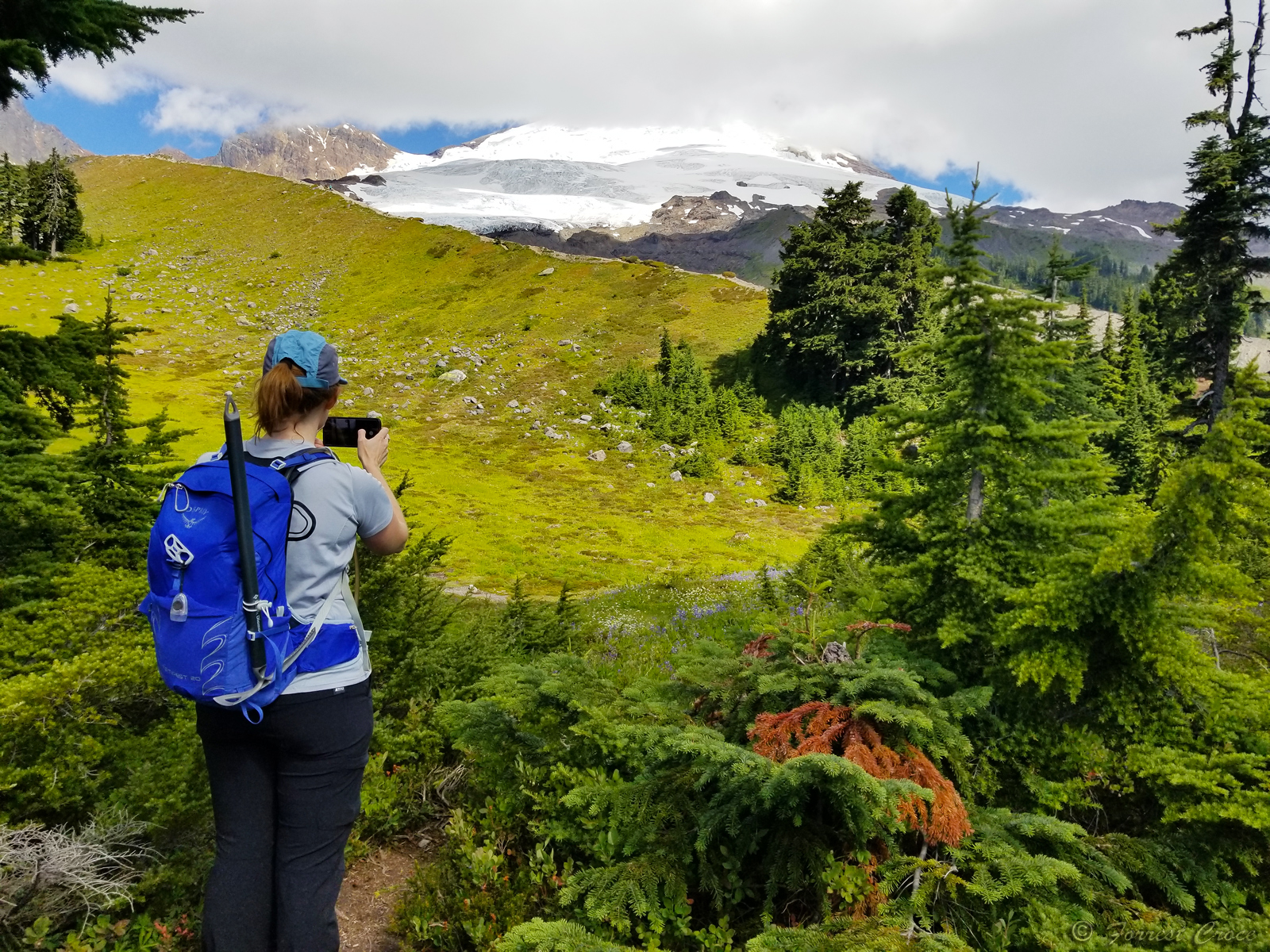
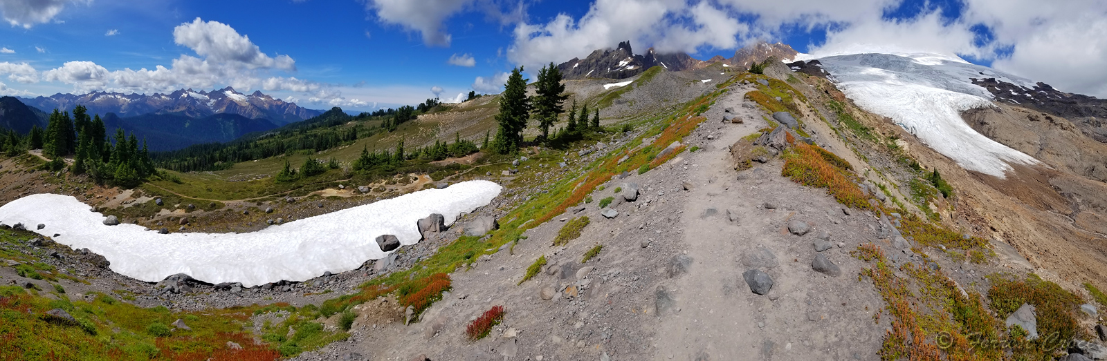
We arrived Sunday morning when most people were leaving. Our trail begins in the woods, no views in here so the pics start a bit later. At this point the trail is pretty rude, gaining 1,000 vertical feet in 2 miles. Then we brake out in this lovely parkland with a dramatic view of the ice cap, our view was especially moody because Komo Kulshan was feeling shy that day.
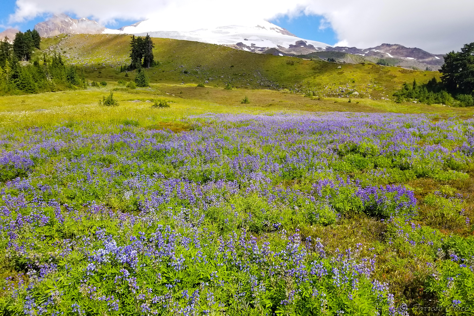
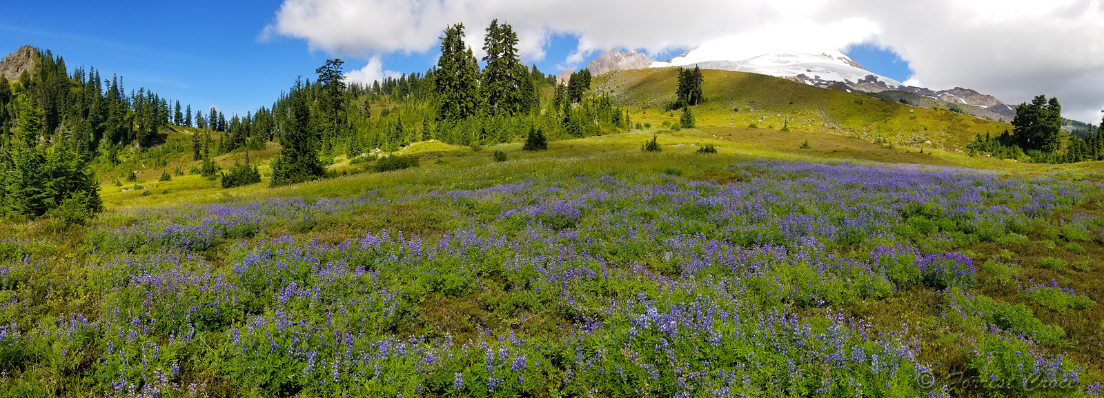
Normally you'd avoid unnecessary down and then back up on a trip like this, but there was a miniature ocean of lupines below and we couldn't not enjoy them.
Finally, the trail gains a ridge and you hike about 2 miles on a heavenly knife edge.
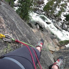
I didn't know that Mary loves cliffs, she became ecstatic at this point and needed to literally run the ridge. Going up, and it's steep.

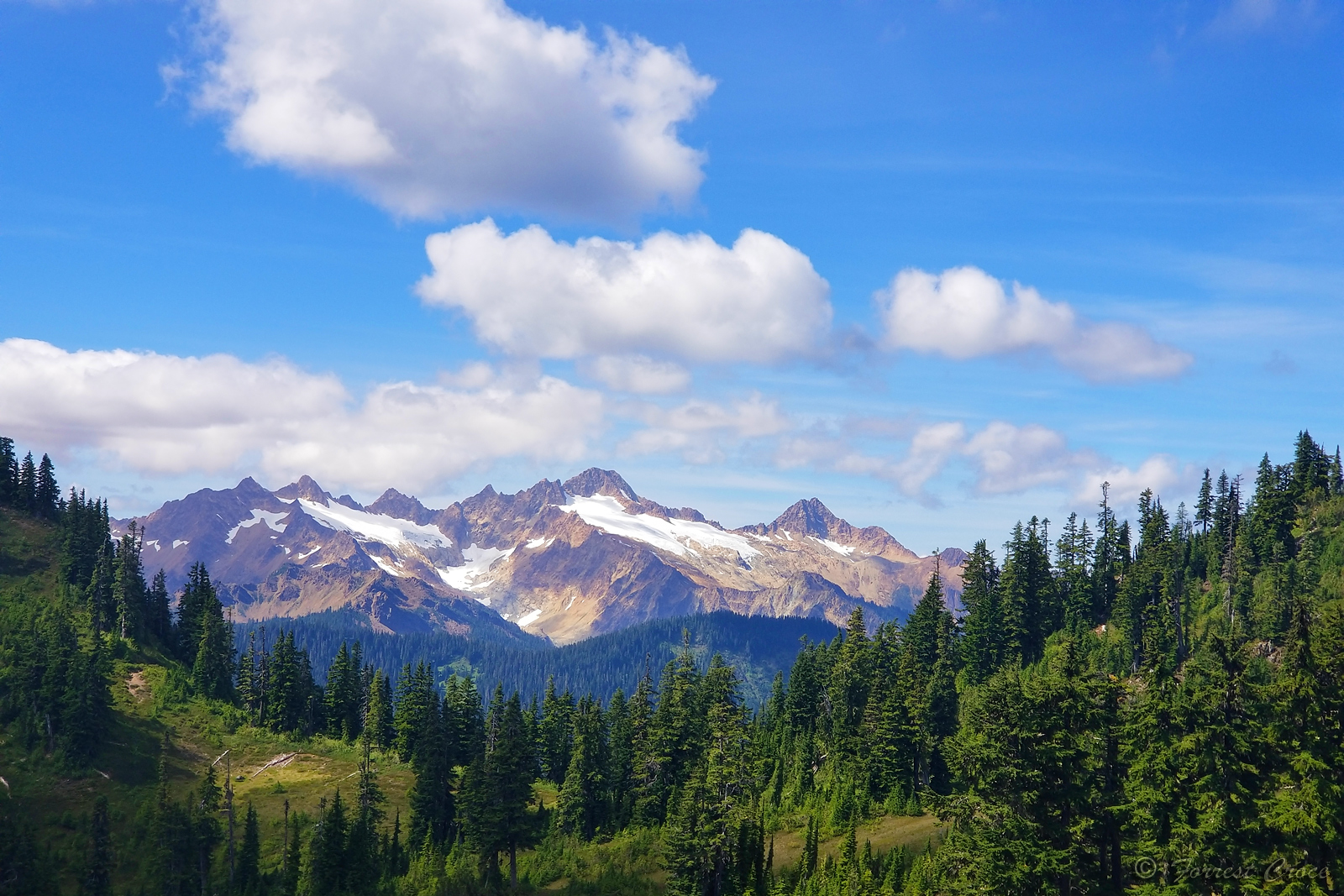
The Sisters, a ridge to the SW of Baker. This one reminds me of an 1800s western painting.
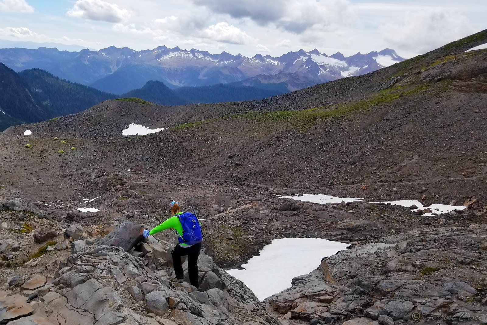
Finally, the trail ends and you can scramble another 1K or so up a rocky rib until you run out of ground and are surrounded only by ice. Our plan was to hike and scramble to this high point, and then frolic on the glacier. At least that was my plan, I assumed it was Mary's plan too, because who can resist an opportunity to play on a glacier? Mary can. So I asked her to give me a few minutes and dropped down to the ice, every time I got near it she yelled "NO!!" and shook her head and waved her arms, like how you'd scold a bad dog. It's not polite to take somebody out of their comfort zone in a place like this, so my primary goal went unattained. Secondary goal of having a great day with a good friend went perfectly, and the third goal of introducing a friend to a new favorite place went swimmingly.
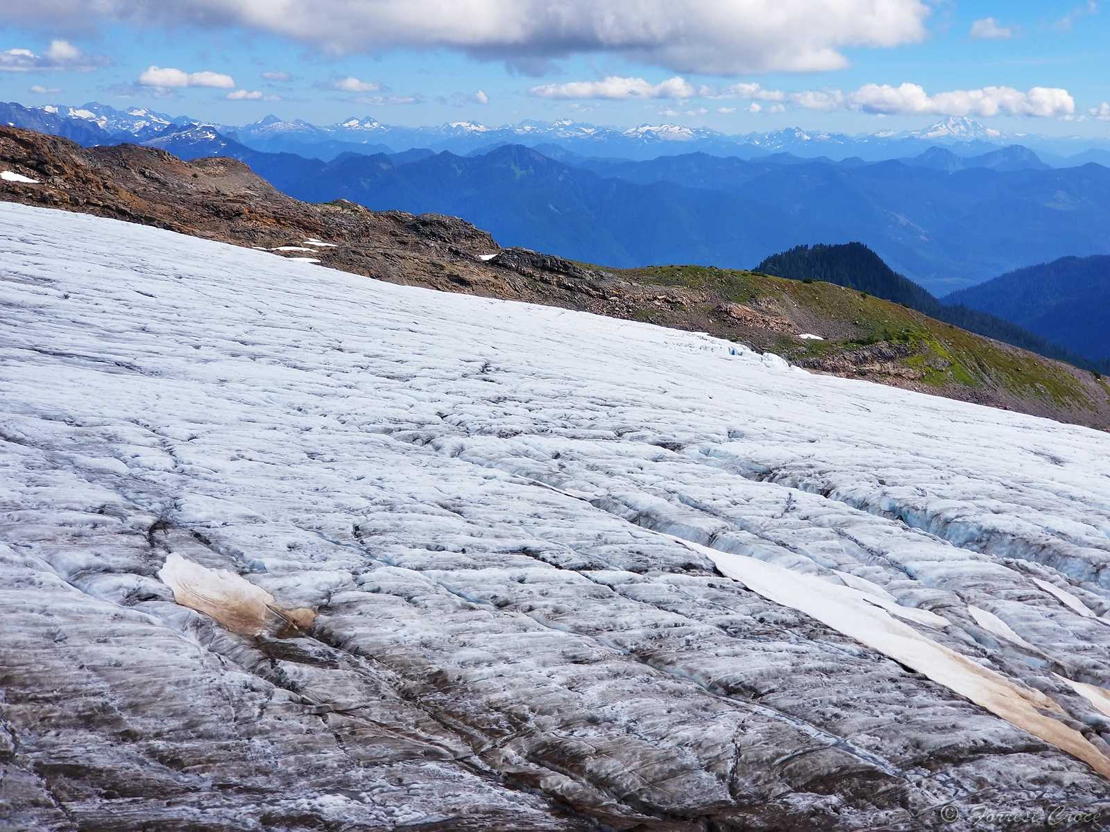
This part of the Easton Glacier is heavily crevassed. You can see a few obvious snow bridges here. Overall this is a pretty hostile glacier.
Heading back down toward the trial.
We probably took longer going down than coming up, the blueberries were ripe. I drove home looking like a smurf.
We arrived Sunday morning when most people were leaving. Our trail begins in the woods, no views in here so the pics start a bit later. At this point the trail is pretty rude, gaining 1,000 vertical feet in 2 miles. Then we brake out in this lovely parkland with a dramatic view of the ice cap, our view was especially moody because Komo Kulshan was feeling shy that day.
Normally you'd avoid unnecessary down and then back up on a trip like this, but there was a miniature ocean of lupines below and we couldn't not enjoy them.
Finally, the trail gains a ridge and you hike about 2 miles on a heavenly knife edge.
I didn't know that Mary loves cliffs, she became ecstatic at this point and needed to literally run the ridge. Going up, and it's steep.
The Sisters, a ridge to the SW of Baker. This one reminds me of an 1800s western painting.
Finally, the trail ends and you can scramble another 1K or so up a rocky rib until you run out of ground and are surrounded only by ice. Our plan was to hike and scramble to this high point, and then frolic on the glacier. At least that was my plan, I assumed it was Mary's plan too, because who can resist an opportunity to play on a glacier? Mary can. So I asked her to give me a few minutes and dropped down to the ice, every time I got near it she yelled "NO!!" and shook her head and waved her arms, like how you'd scold a bad dog. It's not polite to take somebody out of their comfort zone in a place like this, so my primary goal went unattained. Secondary goal of having a great day with a good friend went perfectly, and the third goal of introducing a friend to a new favorite place went swimmingly.
This part of the Easton Glacier is heavily crevassed. You can see a few obvious snow bridges here. Overall this is a pretty hostile glacier.
Heading back down toward the trial.
We probably took longer going down than coming up, the blueberries were ripe. I drove home looking like a smurf.
14
Replies
-
Awesome pictures and great job. Thank you for sharing.1
-
You had me at blueberries. And the lupines were a lagniappe.
I always vicariously enjoy your mountain hikes. Thanks for sharing!3 -
Love the views of some real mountains. What’s the altitude that you had snow/ice? Just seeing the ice is great it’s over 100 degrees here!1
-
cheriej2042 wrote: »Love the views of some real mountains. What’s the altitude that you had snow/ice? Just seeing the ice is great it’s over 100 degrees here!
Looks like it was around 5k, which is surprisingly low for a south face.1 -
(sighs longingly...) 😍
Sounds like a perfect day! Thanks for bringing us along!2 -
Wow, incredible.
So playing on the ice is more dangerous than running up a knife ridge?!
I'm guessing the sense of scale and distance to a flatlander just is not fully appreciated.
On one hand I can review pics of trip to Rockies and wonder how we seemed to come so far, on the other is looking to where we did not go and know from map how much farther that was but pic doesn't seem so bad.
Like the drop down to and back up from the lupines - what kind of time or rough altitude change or distance was that little side trip?
Just gotta put it into perspective of my normal Ozark backpacking up/downs. 300-900 ft is about it normally, just all day long into/out of every creek/river.
How many more weeks before snow starts hitting these fun areas?1


Categories
- All Categories
- 1.4M Health, Wellness and Goals
- 391.5K Introduce Yourself
- 43.5K Getting Started
- 259.7K Health and Weight Loss
- 175.6K Food and Nutrition
- 47.3K Recipes
- 232.3K Fitness and Exercise
- 392 Sleep, Mindfulness and Overall Wellness
- 6.4K Goal: Maintaining Weight
- 8.5K Goal: Gaining Weight and Body Building
- 152.7K Motivation and Support
- 7.8K Challenges
- 1.3K Debate Club
- 96.3K Chit-Chat
- 2.5K Fun and Games
- 3.2K MyFitnessPal Information
- 22 News and Announcements
- 926 Feature Suggestions and Ideas
- 2.3K MyFitnessPal Tech Support Questions