Condor Peak -San Gabriel Mountains
Options

cheriej2042
Posts: 241 Member
I’ve read about this hike and really only serious hikers do it. So I decided to try it and finish it before the really hot weather hits here.
Condor Peak is located in Tujunga Canyon and is 15.75 miles with 4,258 elevation gain. The peak is at 5046 ft and was originally named fir Condors who used the area as a habitat long ago.
This is a long hike with a lot of trail variation (smooth, sandy, rocky,scramble). I missed the first switchback so added some mileage. Overall the trail is narrow and ascends gradually
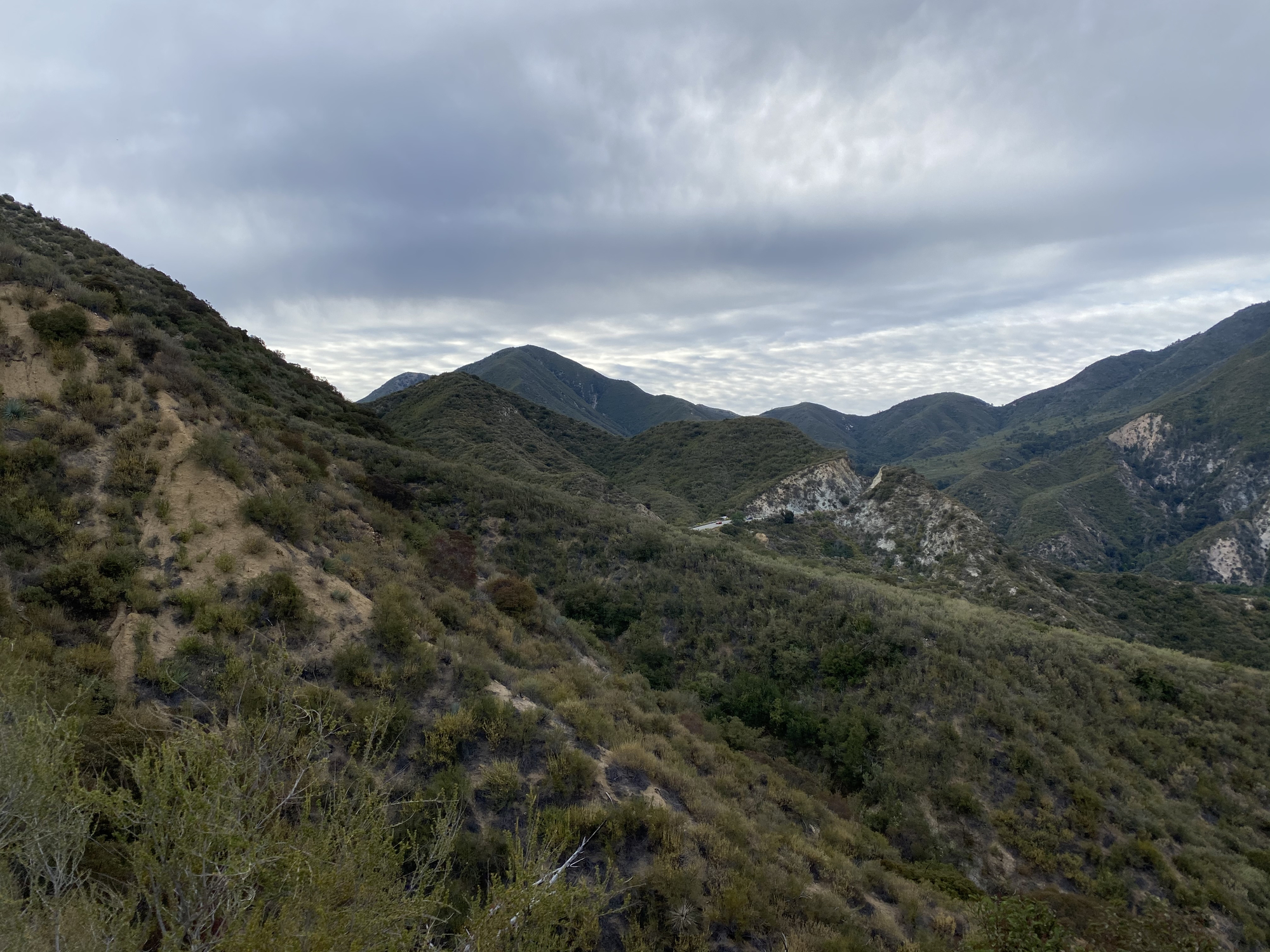


I had some nice cool breezes along the way as the altitude climbed and wrapped around the mountains.
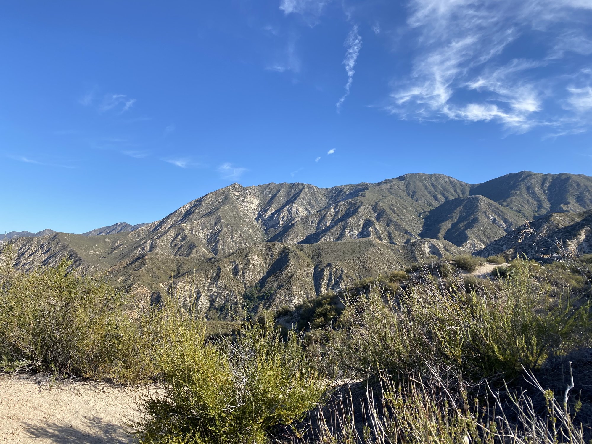
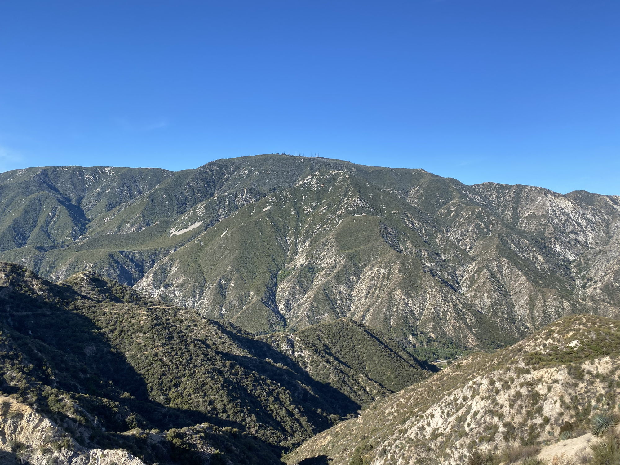
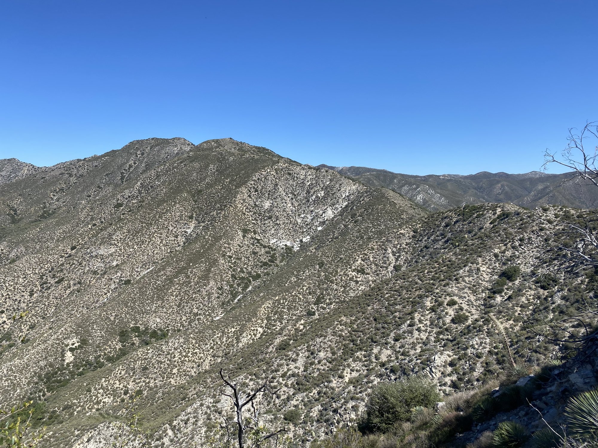
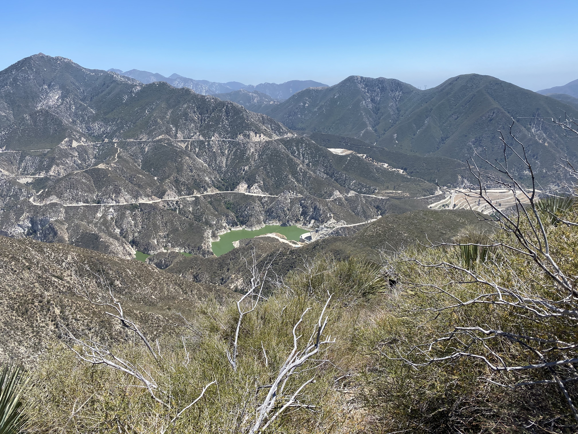
The scramble at the end was quite the event. Someone told me it was a class 2. Views from the summit were clear and I could see on the descent the Big Tujunga Reservoir. I was the only person on the trail.


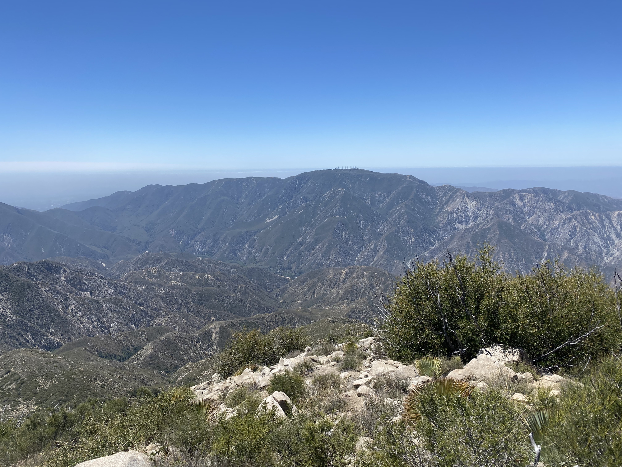

Won’t be hiking here again until the fall due to high temps. It was a good day.
Condor Peak is located in Tujunga Canyon and is 15.75 miles with 4,258 elevation gain. The peak is at 5046 ft and was originally named fir Condors who used the area as a habitat long ago.
This is a long hike with a lot of trail variation (smooth, sandy, rocky,scramble). I missed the first switchback so added some mileage. Overall the trail is narrow and ascends gradually
I had some nice cool breezes along the way as the altitude climbed and wrapped around the mountains.
The scramble at the end was quite the event. Someone told me it was a class 2. Views from the summit were clear and I could see on the descent the Big Tujunga Reservoir. I was the only person on the trail.
Won’t be hiking here again until the fall due to high temps. It was a good day.
3
Replies
-
Beautiful!0
-
You are a very brave, very fit woman! Thanks for that trip report, I would never even attempt that one.
What is the scramble at the end? I don't know that terminology.
Have a pizza! I'm buying.") 0
0 -
I used my Google for the "scramble."0
-
cmriverside wrote: »I used my Google for the "scramble."
Rock scramble means climbing up over boulders using your hands/feet . In this case it was a steep scramble through a cascade of boulders to get to the summit.
1

This discussion has been closed.
Categories
- All Categories
- 1.4M Health, Wellness and Goals
- 396.3K Introduce Yourself
- 44.1K Getting Started
- 260.8K Health and Weight Loss
- 176.3K Food and Nutrition
- 47.6K Recipes
- 232.8K Fitness and Exercise
- 448 Sleep, Mindfulness and Overall Wellness
- 6.5K Goal: Maintaining Weight
- 8.6K Goal: Gaining Weight and Body Building
- 153.3K Motivation and Support
- 8.3K Challenges
- 1.3K Debate Club
- 96.4K Chit-Chat
- 2.5K Fun and Games
- 4.4K MyFitnessPal Information
- 16 News and Announcements
- 18 MyFitnessPal Academy
- 1.4K Feature Suggestions and Ideas
- 3K MyFitnessPal Tech Support Questions