Space
Replies
-
Lights of Java

Astronauts get to observe the Earth in all her beauty from aboard the International Space Station. A member of the Expedition 56 crew currently onboard the station took this nighttime image of Java, Indonesia's largest island.1 -
The NGC 6914 Complex
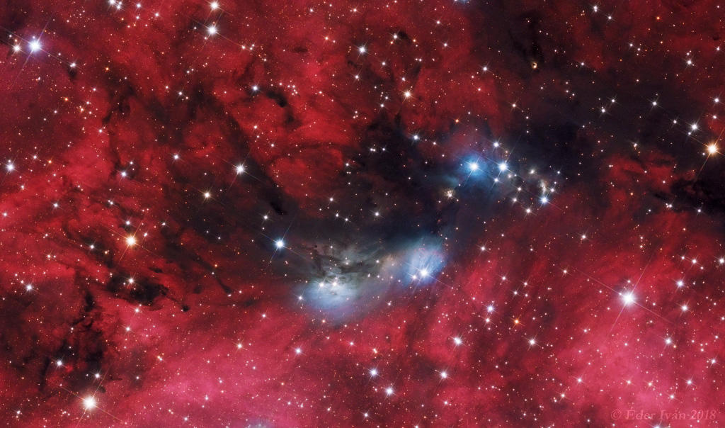
A study in contrasts, this colorful skyscape features stars, dust, and glowing gas in the vicinity of NGC 6914. The complex of reflection nebulae lies some 6,000 light-years away, toward the high-flying northern constellation Cygnus and the plane of our Milky Way Galaxy. Obscuring interstellar dust clouds appear in silhouette while reddish hydrogen emission nebulae, along with the dusty blue reflection nebulae, fill the cosmic canvas.
Ultraviolet radiation from the massive, hot, young stars of the extensive Cygnus OB2 association ionize the region's atomic hydrogen gas, producing the characteristic red glow as protons and electrons recombine. Embedded Cygnus OB2 stars also provide the blue starlight strongly reflected by the dust clouds. The nearly 1 degree wide telescopic field of view spans about 100 light-years at the estimated distance of NGC 6914.1 -

Shortly after midnight Eastern Time on Jan. 1, 2019, NASA’s New Horizons spacecraft will buzz by the most primitive and most distant object ever explored. New Horizons’ encounter with Kuiper Belt object 2014 MU69, which orbits a billion miles beyond Pluto, will offer the first close-up look at such a pristine building block of the solar system.
New Horizons will fly about three times closer to MU69 than it did to Pluto in July 2015, allowing the spacecraft’s cameras to provide a more detailed look at the object’s surface.
Both 2014 MU69 and Pluto are in the Kuiper Belt, is a disc-shaped region beyond Neptune that extends from about 30 to 55 astronomical units (compared to Earth which is one astronomical unit, or AU, from the Sun). Comets from the Kuiper Belt, known as short period comets, take less than 200 years to orbit the Sun and travel approximately in the plane in which most of the planets orbit the Sun. There may be hundreds of thousands of icy bodies and a trillion or more comets in this distant region of our solar system.1 -

Still bright in evening skies, Mars was just past opposition and closest to Earth on July 31, a mere 57.6 million kilometers away. Captured only a week later, this remarkable image shows the Red Planet's disk near its maximum size in earthbound telescopes, but still less than 1/74th the apparent diameter of a Full Moon.
Broad regional surface shadings are starting to reappear in the tantalizing view as the latest planet-wide dust storm subsides. With the bright south polar cap at the bottom, the Valles Marineris extends along the center of the disk. Just below it lies the roughly circular Solis Lacus region sometimes known as the Eye of Mars. In a line, three prominent dark spots left of center are the volcanic Tharsis Montes.
2 -
This is kinda long but VERY cool.
 https://youtu.be/2aCOyOvOw5c 3
 -

The next time you point your telescopes to the sky, look for the Eagle Nebula. Turn your telescope a little bit to the northwest and you’ll see a bright, reddish spot in the sky. That is not any ordinary star – it is the largest star we have ever seen.
It is UY Scuti.
9500 light years away, UY Scuti is in a dense star field in the so-called Zone of Avoidance in space – the area of space obscured by the Milky Way’s disk. The star is so gigantic, and so luminous, that even with the impending stars and space dust, you can see it with binoculars on a dark night.
The largest star in the galaxy is a beautiful and unusual one. It is hard to say exactly how large UY Scuti is – it is really, really far from us and it is a variable star, which means it changes its luminosity. That makes it difficult to judge it’s size accurately – UY Scuti pulsates once every 740 days. By our best estimates, the star is about 7 AU across.2 -
Hubble’s Lucky Observation of an Enigmatic Cloud

The little-known nebula IRAS 05437+2502 billows out among the bright stars and dark dust clouds that surround it.1 -
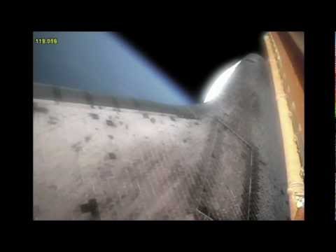
Shuttle leaving our atmosphere.

1 -
NGC 3682: Sideways Spiral Galaxy

What do spiral galaxies look like sideways? Featured is a sharp telescopic view of a magnificent edge-on spiral galaxy NGC 3628, a puffy galactic disk divided by dark dust lanes. Of course, this deep galactic portrait puts some astronomers in mind of its popular moniker, The Hamburger Galaxy.
The tantalizing island universe is about 100,000 light-years across and 35 million light-years away in the northern springtime constellation Leo. NGC 3628 shares its neighborhood in the local Universe with two other large spirals M65 and M66 in a grouping otherwise known as the Leo Triplet. Gravitational interactions with its cosmic neighbors are likely responsible for the extended flare and warp of this spiral's disk.2 -

The shadow covering Discovery, in this image taken by astronaut Paolo Nespoli, was made by the International Space Station as the shuttle prepared to dock.1 -
Kepler-78b is similar to Earth and is referred as “lava world”.
 1
1 -
Photo taken from a F-16 as the shuttle left Earth.

Can you tell I'm a big fan of the Shuttle?
I'm so sad that they no longer fly.
2 -
Anybody ever watch the series "How the Universe Works"? I absolutely love it.4
-
Saturn's North Polar Hexagon

In full view, the amazing six-sided jet stream known as Saturn's north polar hexagon is shown in this colorful Cassini image. Extending to 70 degrees north latitude, the false-color video frame is map-projected, based on infrared, visible, and ultraviolet image data recorded by the Saturn-orbiting spacecraft in late 2012. First found in the outbound Voyager flyby images from the 1980s, the bizarre, long-lived feature tied to the planet's rotation is about 30,000 kilometers across.
At its center lies the ringed gas giant's hurricane-like north polar storm. A new long term study of Cassini data has found a remarkable higher-altitude vortex, exactly matching the outlines of the north polar hexagon, that formed as summer approached the planet's northern hemisphere. It appears to reach hundreds of kilometers above these deeper cloud tops, into Saturn's stratosphere.
1 -
June, 2018
Mars Rover Curiosity snaps a selfie as a giant sandstorm moves across the planet.
3 -

Taken my Nasa's weather satellite
GOES-16.1 -

While astronomers around the world had their eyes fixed last year on ‘Oumuamua, a lump of rock from another planetary system that whizzed through ours, little did they know that another interstellar interloper was quietly living among us. And this one appears to have been here for billions of years.
Astronomers first spotted the object, an asteroid called 2015 BZ509 that is orbiting close to Jupiter, in 2014. They knew it was unusual because it was traveling around the solar system in the opposite direction as almost everything else. (Its motion is shown in the animations above, with 2015 BZ509 circled.)
Astronomers have found other objects in “retrograde” orbits, perhaps knocked off course by passing too close to a giant planet, but 2015 BZ509’s orbit was the weirdest of all because it is also elongated and out of alignment with the planets and other bodies.1 -

This stunning false-color picture shows off the many sides of the supernova remnant Cassiopeia A. It is made up of images taken by three of NASA's Great Observatories, using three different wavebands of light. Infrared data from the Spitzer Space Telescope are colored red; visible data from the Hubble Space Telescope are yellow; and X-ray data from the Chandra X-ray Observatory are green and blue.
Located 10,000 light-years away in the northern constellation Cassiopeia, Cassiopeia A is the remnant of a once massive star that died in a violent supernova explosion 325 years ago. It consists of a dead star, called a neutron star, and a surrounding shell of material that was blasted off as the star died. The neutron star can be seen in the Chandra data as a sharp turquoise dot in the center of the shimmering shell.1 -

Mission Specialist Bruce McCandless II, is seen further away from the confines and safety of his ship than any previous astronaut has ever been.
This space first was made possible by the Manned Manuevering Unit or MMU, a nitrogen jet propelled backpack. After a series of test maneuvers inside and above Challenger’s payload bay, McCandless went “free-flying” to a distance of 320 feet away from the Orbiter.
This stunning orbital panorama view shows McCandless out there amongst the black and blue of Earth and space.
I find this photo a bit terrifying.1 -
Bright Spots On Ceres

Bright surface features on the dwarf planet Ceres known as faculae were first discovered by NASA's Dawn spacecraft in 2015. This mosaic of one such feature, Cerealia Facula, combines images obtained from altitudes as low as 22 miles (35 km) above Ceres' surface. The mosaic is overlain on a topography model based on images obtained during Dawn's low altitude mapping orbit (240 miles or 385 km altitude). No vertical exaggeration was applied. The center of Cerealia Facula is located at 19.7 degrees north latitude and 239.6 degrees south longitude.
During its mission of over a decade, the Dawn spacecraft has studied the asteroid Vesta and dwarf planet Ceres, celestial bodies believed to have formed early in the history of the solar system. The mission's goal is to characterize the early solar system and the processes that dominated its formation.1 -
Hurricane Florence Viewed from the Space Station

Astronaut Ricky Arnold, from aboard the International Space Station, shared this image of Hurricane Florence on Sept. 10, taken as the orbiting laboratory flew over the massive storm.1 -

You have to take a long hike to see the Troll's Tongue -- ten hours over rocky terrain. And in this case, it took three trips to capture the landform below a clear night sky. Trolltunga itself is a picturesque rock protrusion extending about 700 meters over mountainous cliffs near Lake Ringedalsvatnet in Norway.
The overhang is made of billion-year-old Precambrian bedrock that was carved out by glaciers during an ice-age about 10,000 years ago. The featured picture is a composite of two exposures, a 15-second image of the foreground Earth followed 40 minutes later by an 87-second exposure of the background sky. Thousands of discernable stars dot the backdrop starscape in addition to billions of unresolved stars in the nearly vertical band of our Milky Way Galaxy.1 -

Astrophotographer Rolando Ligustri captured this view of Comet 21P/Giacobini-Zinner on Aug. 14, 2018.2 -
@anchower1973 wrote: »Anybody ever watch the series "How the Universe Works"? I absolutely love it.
Yes! My netflix and youtube search history is filled with words like... outer space physics, quantum spacetime, known universe, distant galaxies etc...etc")
You should check out Cosmos: A space time odyssey, if you have not already.
2 -
Alnitak, Alnilam, Mintaka

Alnitak, Alnilam, and Mintaka, are the bright bluish stars from east to west (lower right to upper left) along the diagonal in this cosmic vista. Otherwise known as the Belt of Orion, these three blue supergiant stars are hotter and much more massive than the Sun. They lie from 800 to 1,500 light-years away, born of Orion's well-studied interstellar clouds.
In fact, clouds of gas and dust adrift in this region have some surprisingly familiar shapes, including the dark Horsehead Nebula and Flame Nebula near Alnitak at the lower right. The famous Orion Nebula itself is off the right edge of this colorful starfield. This well-framed, 2-panel telescopic mosaic spans about 4 degrees on the sky.1 -
Hurricane Florence

"Ever stared down the gaping eye of a category 4 hurricane? It's chilling, even from space," says European Space Agency astronaut Alexander Gerst, who is currently living and working aboard the International Space Station as a member of the Expedition 56 crew.
A high-definition video camera outside the space station captured stark and sobering views of Hurricane Florence, a Category 4 storm. The video was taken on Tuesday as Florence churned across the Atlantic in a west-northwesterly direction with winds of 130 miles per hour. The National Hurricane Center forecasts additional strengthening for Florence before it reaches the coastline of North Carolina and South Carolina early Friday, Sept. 14.1 -
Comet, Clusters and Nebulae

Bright enough for binocular viewing Comet 21P / Giacobini-Zinner stands out, even in this deep telephoto mosaic of the star cluster and nebula rich constellation Auriga the Charioteer. On the night of September 9 its greenish coma and diffuse tail contrast with the colorful stars and reddish emission nebulae in the almost 10 degree field of view along the Milky Way. The comet was near its perihelion and closest approach to Earth, about 200 light-seconds away.
Riding across the distant background just above the comet's tail are well-known Auriga star clusters M38 (left of center) and M36 (toward the right) about 4,000 light-years away. At the top left, emission region IC 405 is only 1,500 light-years distant, more dramatically known as the Flaming Star Nebula. To its right lies IC 410, 12,000 light-years away and famous for its star-forming cosmic tadpoles. A child of our Solar System Giacobini-Zinner is a periodic comet orbiting the Sun once every 6.5 years, and the parent body of October's Draconids meteor shower.1 -

Rogue Planet
Hard evidence for the population of planetary nomads has proved elusive—floating cold and lightless in the void, these dark worlds cannot be directly observed by any conceivable telescope.
Very rarely, however, one might pass in front of a far-distant background star, creating a detectable blip of light as the planet’s gravitational field acts as a magnifying lens.
The duration and strength of such a “gravitational microlensing” event could reveal not only a rogue planet’s existence but also its mass, as bigger worlds tend to create longer, stronger amplifications of a background star’s light.
A typical free-floating Jupiter-mass planet, for instance, is estimated to create an amplification lasting one to several days. A smaller, Earth-sized object might only amplify a star for a few hours.
It takes intensive calculations and a complicated series of assumptions to extract a rogue planet’s basic details from the deceptively simple brightening of faraway stars.
But experts broadly agree that it can be done—so a handful of telescopic surveys around the world now monitor hundreds of millions of suns night after night to seek these objects, gradually taking a bulk census of the Milky Way’s loneliest worlds from the telltale twinkles of chance cosmic alignments.1 -

The Black Widow Pulsar
Pulsar J1311-3430 is a dangerous partner to have.
It weighs as much as two suns but is only as wide as Washington, DC — and it's getting bigger by feeding off its mate, a normal star. The two pirouette around each other every 93 minutes in a deadly, close dance.
The pulsar’s beam strips layers away from the star, which the pulsar then slurps up. That extra material gives the pulsar more energy, making it spin even faster, but leaving its partner depleted. So depleted that someday, nothing will be left and the pulsar will dance with only itself.
1 -

This planet’s blue hue might call to mind peaceful oceans and pleasant summer days. But don’t be fooled. It’s a huge gas giant orbiting close to its star, which would makes it a hellish place to live, for a few reasons:
a) No oceans exist ever, b) the temperature rockets as high as 1,700 degrees Fahrenheit, and c) the apparent azure sky actually comes from a deadly weather pattern: rain made of molten glass.1


This discussion has been closed.
Categories
- All Categories
- 1.4M Health, Wellness and Goals
- 398.5K Introduce Yourself
- 44.7K Getting Started
- 261K Health and Weight Loss
- 176.4K Food and Nutrition
- 47.7K Recipes
- 233K Fitness and Exercise
- 462 Sleep, Mindfulness and Overall Wellness
- 6.5K Goal: Maintaining Weight
- 8.7K Goal: Gaining Weight and Body Building
- 153.5K Motivation and Support
- 8.4K Challenges
- 1.4K Debate Club
- 96.5K Chit-Chat
- 2.6K Fun and Games
- 4.8K MyFitnessPal Information
- 18 News and Announcements
- 21 MyFitnessPal Academy
- 1.5K Feature Suggestions and Ideas
- 3.2K MyFitnessPal Tech Support Questions