Space
Replies
-

1 -
Don't know if anyone ever posted this here on this thread, but it seems appropriate, and I thought it was pretty awesome. Apologies if it's a repeat...
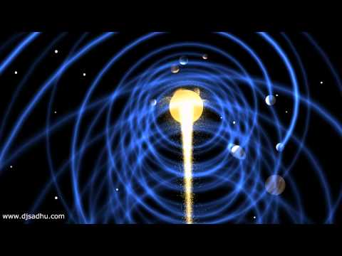 https://www.youtube.com/watch?v=0jHsq36_NTU 1
 -
Juno Captures Elusive 'Brown Barge'

A long, brown oval known as a "brown barge" in Jupiter's South Equatorial Belt is captured in this color-enhanced image from NASA's Juno spacecraft.2 -
ICESat-2 Lifts Off to Study Earth's Changing Ice

A Delta II rocket launches with NASA's ICESat-2 onboard, Saturday, Sept. 15, 2018, from Vandenberg Air Force Base in California.2 -
Cocoon Nebula Deep Field

Inside the Cocoon Nebula is a newly developing cluster of stars. The cosmic Cocoon on the upper right also punctuates a long trail of obscuring interstellar dust clouds to its left. Cataloged as IC 5146, the beautiful nebula is nearly 15 light-years wide, located some 3,300 light years away toward the northern constellation of the Swan (Cygnus).
Like other star forming regions, it stands out in red, glowing, hydrogen gas excited by young, hot stars and blue, dust-reflected starlight at the edge of a nearly invisible molecular cloud. In fact, the bright star near the center of this nebula is likely only a few hundred thousand years old, powering the nebular glow as it slowly clears out a cavity in the molecular cloud's star forming dust and gas.
This exceptionally deep color view of the Cocoon Nebula traces tantalizing features within and surrounding the dusty stellar nursery.1 -

A remote galaxy shining with the light of more than 300 trillion suns has been discovered using data from NASA's Wide-field Infrared Survey Explorer (WISE). The galaxy is the most luminous galaxy found to date and belongs to a new class of objects recently discovered by WISE -- extremely luminous infrared galaxies, or ELIRGs.
The brilliant galaxy, known as WISE J224607.57-052635.0, may have a behemoth black hole at its belly, gorging itself on gas. Supermassive black holes draw gas and matter into a disk around them, heating the disk to roaring temperatures of millions of degrees and blasting out high-energy, visible, ultraviolet and X-ray light. The light is blocked by surrounding cocoons of dust. As the dust heats up, it radiates infrared light.1 -
First Light Data for NASA's Parker Solar Probe

Just over a month into its mission, NASA's Parker Solar Probe has returned first-light data from each of its four instrument suites. These early observations – while not yet examples of the key science observations Parker Solar Probe will take closer to the Sun – show that each of the instruments is working well. The instruments work in tandem to measure the Sun’s electric and magnetic fields, particles from the Sun and the solar wind, and capture images of the environment around the spacecraft.
This image shows the first-light data from Parker Solar Probe's WISPR (Wide-field Imager for Solar Probe) instrument suite. The right side of this image — from WISPR's inner telescope — has a 40-degree field of view, with its right edge 58.5 degrees from the Sun's center. The bright object slightly to the right of the image's center is Jupiter. The left side of the image is from WISPR’s outer telescope, which has a 58-degree field of view and extends to about 160 degrees from the Sun. It shows the Milky Way, looking at the galactic center. There is a parallax of about 13 degrees in the apparent position of the Sun as viewed from Earth and from Parker Solar Probe.1 -
Small Satellite Demonstrates Possible Solution for 'Space Junk'

The International Space Station serves as humanity's orbital research platform, conducting a variety of experiments and research projects while in orbit around the planet.
On June 20, 2018, the space station deployed the NanoRacks-Remove Debris satellite into space from outside the Japanese Kibo laboratory module. This technology demonstration was designed to explore using a 3D camera to map the location and speed of orbital debris or "space junk."
The NanoRacks-Remove Debris satellite successfully deployed a net to capture a nanosatellite that simulates debris. Collisions in space could have have serious consequences to the space station and satellites, but research has shown that removing the largest debris significantly reduces the chance of collisions.1 -

— A photo of the International Space Station passing in front of a dazzling full moon could put Lucas Films’ special effects to shame.
Australian photographer Dylan O’Donnell spent 12 months waiting for the perfect moment when the ISS would enter the same frame as a full moon.2 -
Hubble’s Galaxies With Knots, Bursts

In the northern constellation of Coma Berenices lies the impressive Coma Cluster — a structure of over a thousand galaxies bound together by gravity.1 -

The Moon’s orbit around Earth means it’s distance from the Sun changes over time.
The reason the moon is at its brightest during a Full Moon is simply because it is during this phase that it is exactly opposite the Sun.
However, as it gets closer to the New Moon phase of its cycle, its distance from the Sun decreases. This means that while it is less visible at night, during the daytime, it is more luminous.1 -

A Japanese spacecraft released two small rovers on an asteroid on Friday (Sept 21, 2018) in a mission that could provide clues to the origin of the solar system.
The Japan Space Exploration Agency said the two Minerva-II-1 rovers were lowered from the unmanned spacecraft Hayabusa2 to the asteroid Ryugu. The spacecraft arrived near the asteroid, about 280 million kilometers (170 million miles) from Earth, in June.
The two rovers, each about the size of a cookie can, are to capture images of the asteroid and measure surface temperatures before a larger rover and a lander are released later.
The rovers move by “hopping” up to 15 meters (50 feet) at a time because the extremely weak gravity on the asteroid makes rolling difficult.
They can continue jumping as long as their solar panels and power last, JAXA said.
2 -
John Young Makes Last Minute Inspection of Gemini III

John W. Young (1930-2018), born on Sept. 24, was NASA's longest-serving astronaut and the only astronaut to fly missions in the Gemini, Apollo and Space Shuttle Programs.1 -
Highlights of the North Autumn Sky

What can you see in the night sky this season? The featured graphic gives a few highlights for Earth's northern hemisphere. Viewed as a clock face centered at the bottom, early (northern) autumn sky events fan out toward the left, while late autumn events are projected toward the right. Objects relatively close to Earth are illustrated, in general, as nearer to the cartoon figure with the telescope at the bottom center -- although almost everything pictured can be seen without a telescope.
As happens during any season, constellations appear the same year to year, and, as usual, the Leonids meteor shower will peak in mid-November. Also as usual, the International Space Station (ISS) can be seen, at times, as a bright spot drifting across the sky after sunset. Planets visible after sunset this autumn include Jupiter and Mars, and during late autumn, Saturn.
1 -
Our Sun: Two Wavelengths, Two Different Images

NASA's Solar Dynamics Observatory views our Sun in ten different wavelengths because each wavelength reveals different solar features.1 -
Opportunity Emerges in a Dusty Picture

ASA still hasn't heard from the Opportunity rover, but at least we can see it again.
A new image produced by HiRISE, a high-resolution camera aboard NASA's Mars Reconnaissance Orbiter (MRO), shows a small object on the slopes of the Red Planet's Perseverance Valley. That object is Opportunity, which was descending into the Martian valley when a dust storm swept over the region a little more than 100 days ago.
The storm was one of several that stirred up enough dust to enshroud most of the Red Planet and block sunlight from reaching the surface. The lack of sunlight caused the solar-powered Opportunity to go into hibernation.
The rover's team at NASA's Jet Propulsion Laboratory in Pasadena, California, hasn't heard from it since. On Sept. 11, JPL began increasing the frequency of commands it beams to the 14-year-old rover.
The tau -- a measurement of how much sunlight reaches the surface -- over Opportunity was estimated to be a little higher than 10 during some points during the dust storm. The tau has steadily fallen in the last several months. On Thursday, Sept. 20, when this image was taken, tau was estimated to be about 1.3 by MRO's Mars Color Imager camera.
This image was produced from about 166 miles (267 kilometers) above the Martian surface. The white box marks a 154-foot-wide (47-meter-wide) area centered on the rover.2 -
1
-

This colorful skyscape spans about two full moons across nebula rich starfields along the plane of our Milky Way Galaxy in the royal northern constellation Cepheus. Near the edge of the region's massive molecular cloud some 2,400 light-years away, bright reddish emission region Sharpless (Sh) 155 is below and right of center, also known as the Cave Nebula. About 10 light-years across the cosmic cave's bright walls of gas are ionized by ultraviolet light from the hot young stars around it.
Dusty blue reflection nebulae, like vdB 155 at upper left, and dense obscuring clouds of dust also abound on the interstellar canvas. Astronomical explorations have revealed other dramatic signs of star formation, including the bright red fleck of Herbig-Haro (HH) 168. Near top center in the frame, the Herbig-Haro object emission is generated by energetic jets from a newborn star.1 -
-
The First Rocket Launch from Cape Canaveral

A new chapter in space flight began in 1950 with the launch of the first rocket from Cape Canaveral, Florida: the Bumper V-2. Featured here, the Bumper V-2 was an ambitious two-stage rocket program that topped a V-2 missile base with a WAC Corporal rocket. The upper stage was able to reach then-record altitudes of almost 400 kilometers, higher than even International Space Station.
Launched under the direction of the General Electric Company, the Bumper V-2 was used primarily for testing rocket systems and for research on the upper atmosphere. Bumper V-2 rockets carried small payloads that allowed them to measure attributes including air temperature and cosmic ray impacts. Seven years later, the Soviet Union launched Sputnik I and Sputnik II, the first satellites into Earth orbit. In response in 1958, 60 years ago today, the USA created NASA.
2 -
The Lonely Neutron Star in Supernova Remnant E0102-72.3

Why is this neutron star off-center? Recently a lone neutron star has been found within the debris left over from an old supernova explosion. The "lonely neutron star" in question is the blue dot at the center of the red nebula near the bottom left of E0102-72.3. In the featured image composite, blue represents X-ray light captured by NASA's Chandra Observatory, while red and green represent optical light captured by ESO's Very Large Telescope in Chile and NASA's Hubble Space Telescope in orbit.
The displaced position of this neutron star is unexpected since the dense star is thought to be the core of the star that exploded in the supernova and created the outer nebula. It could be that the neutron star in E0102 was pushed away from the nebula's center by the supernova itself, but then it seems odd that the smaller red ring remains centered on the neutron star. Alternatively, the outer nebula could have been expelled during a different scenario -- perhaps even involving another star. Future observations of the nebulas and neutron star appear likely to resolve the situation.
2 -
back in the 1940 in October they kept trying to launch the V2, but it done kept getting all blowed-up.The First Rocket Launch from Cape Canaveral
A new chapter in space flight began in 1950 with the launch of the first rocket from Cape Canaveral, Florida: the Bumper V-2. Featured here, the Bumper V-2 was an ambitious two-stage rocket program that topped a V-2 missile base with a WAC Corporal rocket. The upper stage was able to reach then-record altitudes of almost 400 kilometers, higher than even International Space Station.
Launched under the direction of the General Electric Company, the Bumper V-2 was used primarily for testing rocket systems and for research on the upper atmosphere. Bumper V-2 rockets carried small payloads that allowed them to measure attributes including air temperature and cosmic ray impacts. Seven years later, the Soviet Union launched Sputnik I and Sputnik II, the first satellites into Earth orbit. In response in 1958, 60 years ago today, the USA created NASA.1 -

The planet – Proxima b – was discovered by astronomers who spent years looking for signs of the tiny gravitational tug exerted by a planet on its star, after spotting hints of such disruption in 2013.
Proxima Centauri is 4.25 light years from Earth, making it slightly closer than the binary star system of Alpha Centauri, which the Proxima star is thought to loosely orbit.
The planet is likely to be 30 percent more massive than Earth, although it could be bigger than that.
It orbits the star at a distance of 7.3 million kilometres – less than 5 per cent of the distance between Earth and the sun – making its year last just 11.2 Earth days.
Proxima Centauri is a small, red dwarf star and shines much less fiercely than the sun.
Standing on the surface of the planet, you’d see the star as a dull red orb, about three times as large as the sun appears from Earth.
As a result, the planet sits in its star’s habitable zone, and its surface temperature may be right for it to host liquid water.1 -
55 Nights with Saturn

For 55 consecutive nights Mediterranean skies were at least partly clear this summer, from the 1st of July to the 24th of August 2018. An exposure from each night was incorporated in this composited telephoto and telescopic image to follow bright planet Saturn as it wandered through the generous evening skies. Through August, the outer planet's seasonal apparent retrograde motion slowed and drifted to the right, framed by a starry background.
That brought it near the line-of-sight to the central Milky Way, and the beautiful Lagoon (M8) and Trifid (20) nebulae. Of course Saturn's largest moon Titan was also along for the ride. Swinging around the gas giant in a 16 day long orbit, Titan's resulting wave-like motion is easier to spot when the almost-too-bright Saturn is digitally edited from the scene.1 -

Discovery,
the veteran of the fleet, is NASA's oldest and most traveled shuttle.
After 27 years and 39 flights, Discovery has logged 365 days — a full year — in space, and journeyed 148,221,675 miles (238,539,663 km).
Over its career, Discovery also made 5,830 orbits of the Earth.
Discovery made its maiden launch on the STS-41D mission in August 1984.
The workhorse orbiter lifted off on its final flight, STS-133, on Feb. 24, 2011.
The busy 13-day mission to the International Space Station capped off Discovery's prolific career, which includes the deployment of the Hubble Space Telescope in April 1990.
Discovery was the first shuttle to visit the International Space Station in May 1999, and would return to the outpost another 12 times.
NASA's fleet leader also performed both return-to-flight missions after the shuttle program was grounded following the losses of Challenger and Columbia.2 -

3 -

2 -

One of the stranger space sagas in recent memory involves a small hole in a spacecraft attached to the International Space Station that has spawned speculation, scrutiny and a pair of investigations from NASA and Roscosmos, the Russian space agency.
The latest development in the story comes from NASA, which issued on Wednesday a statement about the leak investigation and expressed confidence in Russia's Soyuz spacecraft.
The odd tale started on Aug. 29 with the discovery of a small hole in a Soyuz craft attached to the ISS.
Early speculation on the cause touched on everything from a puncture caused by space debris to a manufacturing mistake to deliberate sabotage.
The ISS crew quickly repaired the hole and stopped a small pressure leak.
NASA's statement comes after Roscosmos general director Dmitry Rogozin said the investigation has ruled out a manufacturing defect. Rogozin said early in September the hole appeared to be made by a person with a drill.
The International Space Station program is tentatively planning a spacewalk for November to examine the hole from the outside.2 -
NGC 1898: Globular Cluster in the Large Magellanic Cloud

Jewels don't shine this bright -- only stars do. And almost every spot in this glittering jewel-box of an image from the Hubble Space Telescope is a star. Now some stars are more red than our Sun, and some more blue -- but all of them are much farther away. Although it takes light about 8 minutes to reach Earth from the Sun, NGC 1898 is so far away that it takes light about 160,000 years to get here.
This huge ball of stars, NGC 1898, is called a globular cluster and resides in the central bar of the Large Magellanic Cloud (LMC) -- a satellite galaxy of our large Milky Way Galaxy. The featured multi-colored image includes light from the infrared to the ultraviolet and was taken to help determine if the stars of NGC 1898 all formed at the same time, or at different times.
There are increasing indications that most globular clusters formed stars in stages, and that, in particular, stars from NGC 1898 formed shortly after ancient encounters with the Small Magellanic Cloud (SMC) and our Milky Way Galaxy.
2 -
The Blue Horsehead Nebula in Infrared

The Blue Horsehead Nebula looks quite different in infrared light. In visible light, the reflecting dust of the nebula appears blue and shaped like a horse's head. In infrared light, however, a complex labyrinth of filaments, caverns, and cocoons of glowing dust and gas emerges, making it hard to even identify the equine icon. The featured image of the nebula was created in three infrared colors (R=22, G=12, B=4.6 microns) from data taken by NASA's orbiting Wide Field Infrared Survey Explorer (WISE) spacecraft.
The nebula is cataloged as IC 4592 and spans about 40 light years, lying about 400 light years away toward the constellation Scorpius along the plane of our Milky Way Galaxy. IC 4592 is fainter but covers an angularly greater region than the better known Horsehead Nebula of Orion. The star that predominantly illuminates and heats the dust is Nu Scorpii, visible as the reddened star left of center.2


 https://youtu.be/_1gfV3gZhE4


This discussion has been closed.
Categories
- All Categories
- 1.4M Health, Wellness and Goals
- 396.9K Introduce Yourself
- 44.2K Getting Started
- 260.9K Health and Weight Loss
- 176.3K Food and Nutrition
- 47.6K Recipes
- 232.8K Fitness and Exercise
- 454 Sleep, Mindfulness and Overall Wellness
- 6.5K Goal: Maintaining Weight
- 8.7K Goal: Gaining Weight and Body Building
- 153.3K Motivation and Support
- 8.3K Challenges
- 1.3K Debate Club
- 96.5K Chit-Chat
- 2.6K Fun and Games
- 4.5K MyFitnessPal Information
- 16 News and Announcements
- 18 MyFitnessPal Academy
- 1.4K Feature Suggestions and Ideas
- 3.1K MyFitnessPal Tech Support Questions